How many types of drawing are there in civil engineering?
Introduction
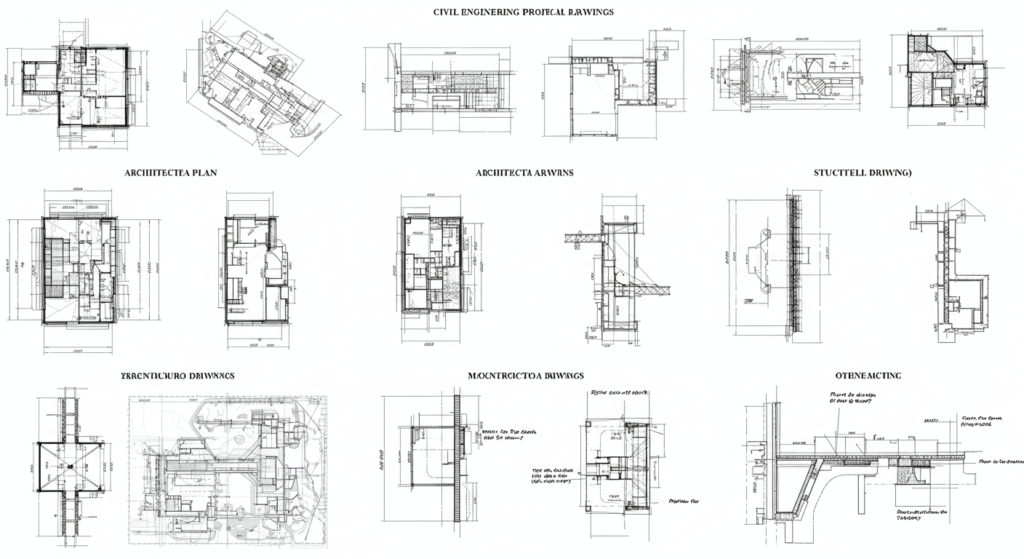
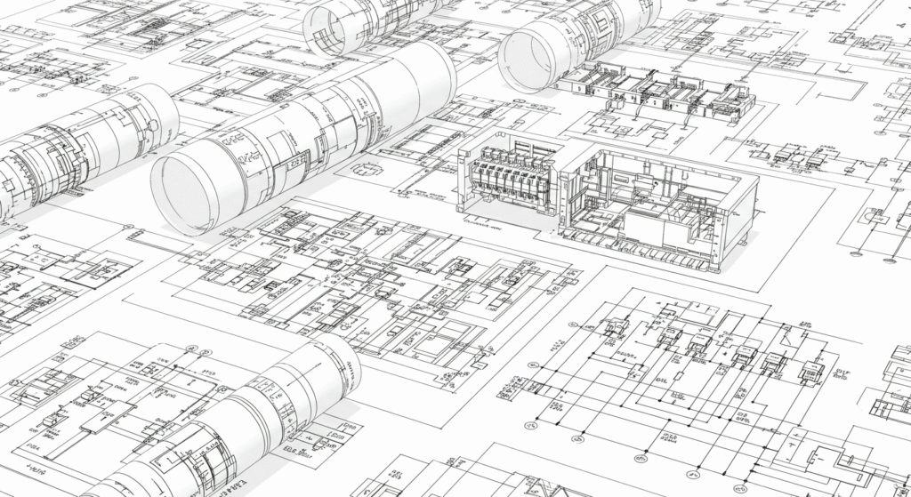
Civil engineering is a diverse and complex field that involves the planning, design, construction, and maintenance of infrastructure. At the heart of every civil engineering project are the drawings that provide the visual representation of the plans, designs, and specifications. These drawings are essential for communicating ideas, ensuring that all stakeholders understand the project requirements, and guiding the construction process. In this article, we will explore the various types of drawings used in civil engineering, their purposes, and their significance in the successful completion of projects.
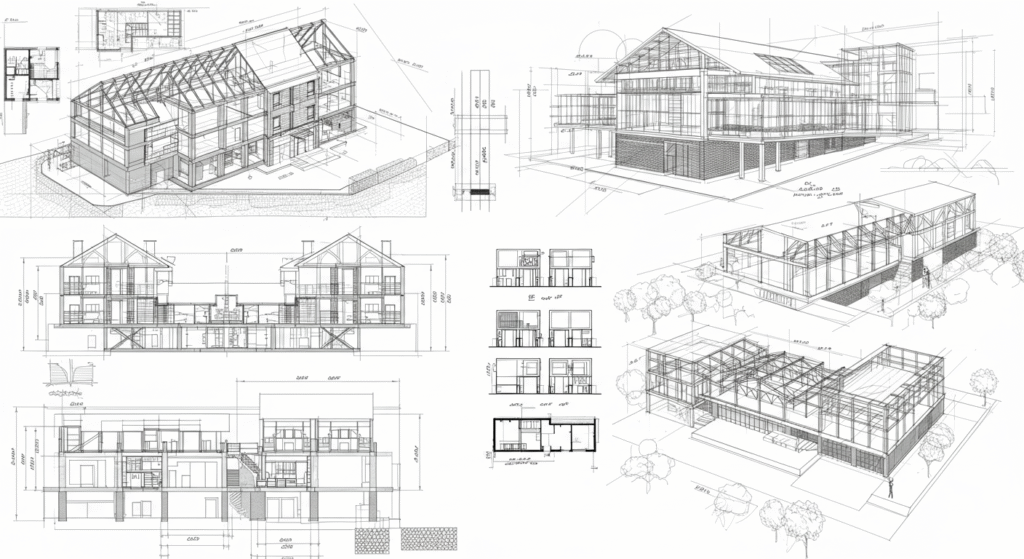
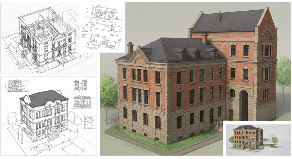
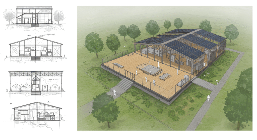
1. Architectural Drawings
Architectural drawings are the first type of drawings in any civil engineering project. These drawings focus on the aesthetic and functional aspects of buildings and other structures. They provide a visual representation of the design, including the layout, proportions, and appearance of the building. Architectural drawings are typically used during the early stages of a project to convey the overall design concept to clients and stakeholders.
- Types of Architectural Drawings:
- Floor Plans: These drawings show the layout of each floor of a building, including the location of rooms, doors, windows, and other features.
- Elevations: These drawings provide a view of the exterior of the building from different angles, showing the height, proportions, and architectural features.
- Cross-Sectional Views: These drawings show a cross-section of the building, providing a detailed view of the internal structure and components.
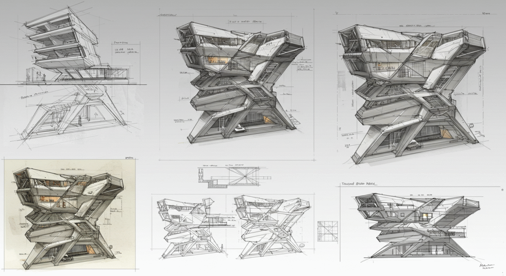
- Perspective Drawings: These drawings provide a three-dimensional view of the building, giving a realistic representation of how the building will look when completed.
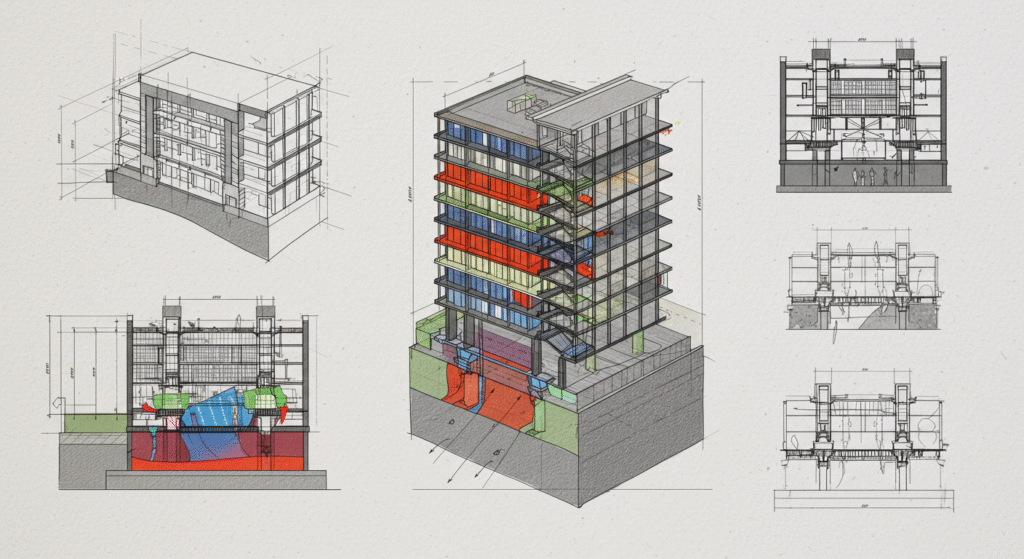
2. Structural Drawings
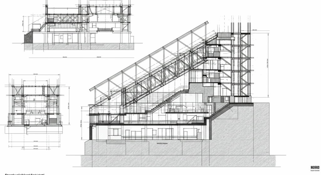
Structural drawings are critical in civil engineering as they detail the framework of a building or structure. These drawings show the structural elements that provide support and stability to the building, such as beams, columns, foundations, and walls. Structural drawings are essential for ensuring that the building can withstand various loads and stresses, including weight, wind, and seismic activity.
- Types of Structural Drawings:
- Foundation Plans: These drawings show the layout and details of the foundation, including the type of foundation, its depth, and the materials used.
- Framing Plans: These drawings show the layout of the structural framework, including beams, columns, and their connections.
- Sectional Views: These drawings provide a detailed cross-sectional view of structural elements, showing their dimensions and materials.
- Connection Details: These drawings show the details of how different structural elements are connected, including bolts, welds, and other fasteners.
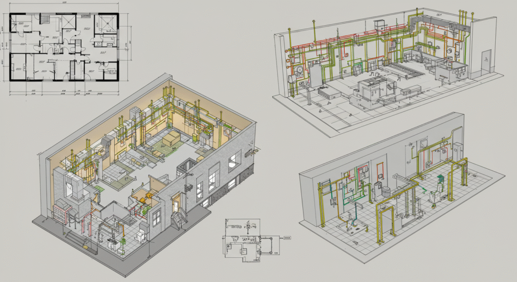
3. Mechanical Drawings
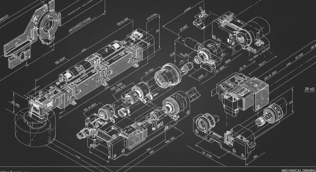
Mechanical drawings detail the mechanical systems within a building or structure. These systems include heating, ventilation, and air conditioning (HVAC), plumbing, and piping. Mechanical drawings are essential for ensuring that these systems are installed correctly and function efficiently.
- Types of Mechanical Drawings:
- HVAC Plans: These drawings show the layout of the HVAC system, including ductwork, vents, and equipment locations.
- Piping Plans: These drawings show the layout of piping systems, including the location of pipes, valves, and fittings.
- Equipment Layouts: These drawings show the location and details of mechanical equipment, such as boilers, chillers, and pumps.
- Control Diagrams: These drawings show the control systems for mechanical equipment, including wiring, sensors, and control panels.
4. Electrical Drawings
Electrical drawings provide a detailed layout of the electrical systems within a building or structure. These systems include wiring, circuits, electrical panels, and other electrical components. Electrical drawings are essential for ensuring that the electrical systems are installed safely and efficiently.
- Types of Electrical Drawings:
- Power Plans: These drawings show the layout of the electrical power distribution system, including the location of electrical panels, circuit breakers, and outlets.
- Lighting Plans: These drawings show the layout of lighting fixtures, including their location and type.
- Wiring Diagrams: These drawings show the detailed wiring connections for electrical circuits and devices.
- Control Diagrams: These drawings show the control systems for electrical equipment, including switches, relays, and control panels.
5. Plumbing Drawings
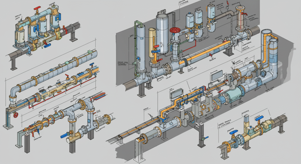
Plumbing drawings detail the layout of water supply, drainage, and gas systems within a building or structure. These drawings are essential for ensuring that these systems are installed correctly and function efficiently.
- Types of Plumbing Drawings:
- Water Supply Plans: These drawings show the layout of the water supply system, including the location of pipes, valves, and fixtures.
- Drainage Plans: These drawings show the layout of the drainage system, including the location of pipes, traps, and vents.
- Gas Plans: These drawings show the layout of the gas supply system, including the location of pipes, valves, and appliances.
- Fixture Installation Details: These drawings show the details of how plumbing fixtures, such as sinks and toilets, are installed.
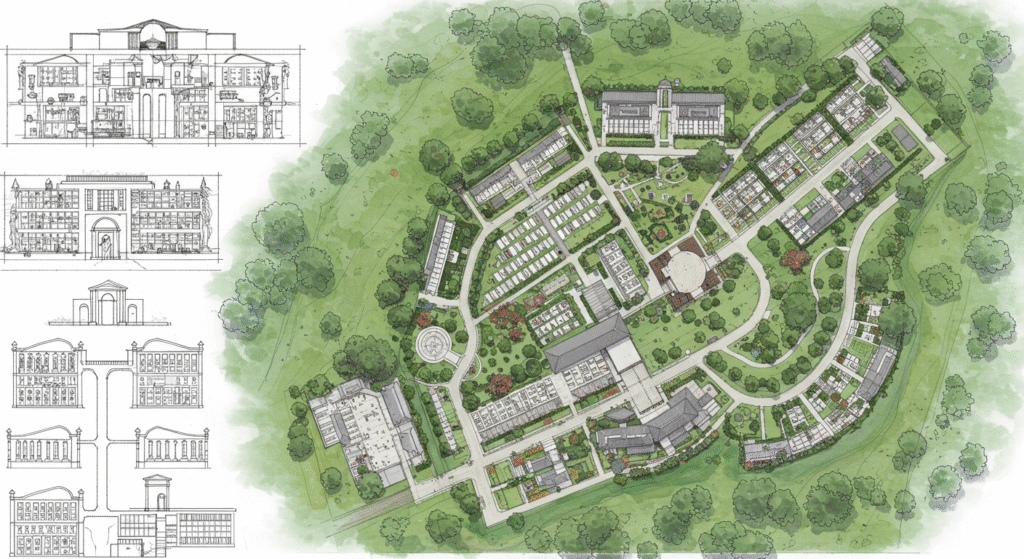
6. Site Plans
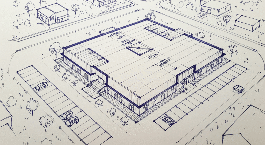
Site plans provide a comprehensive view of the entire project site, including the location of buildings, roads, utilities, and landscaping. These drawings are essential for planning and executing large-scale construction projects.
- Types of Site Plans:
- Topographic Maps: These drawings show the natural features of the site, including contours, elevations, and water bodies.
- Utility Plans: These drawings show the location of utilities, such as water, sewer, and electricity lines.
- Landscaping Plans: These drawings show the layout of landscaping features, including plants, trees, and hardscaping.
- Access and Circulation Plans: These drawings show the layout of roads, parking lots, and pedestrian paths.
7. Elevation Drawings
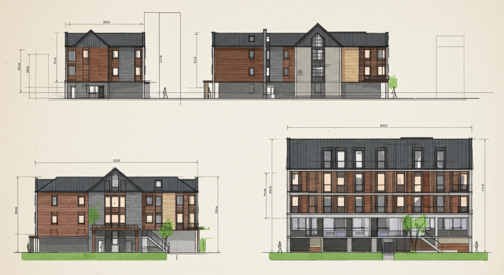
Elevation drawings provide a detailed view of the exterior of a building or structure from different angles. These drawings are essential for visualizing the final appearance of the building and ensuring that it meets aesthetic and functional requirements.
- Types of Elevation Drawings:
- Front Elevation: This drawing shows the front view of the building.
- Side Elevation: This drawing shows the side view of the building.
- Rear Elevation: This drawing shows the rear view of the building.
- Sectional Elevations: These drawings show a detailed view of specific sections of the building.
8. Cross-Sectional Drawings
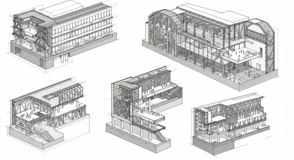
Cross-sectional drawings provide a detailed view of the internal structure of a building or object, showing the relationship between different components. These drawings are essential for understanding the composition and construction of various elements within a project.
- Types of Cross-Sectional Drawings:
- Building Cross-Sections: These drawings show a cross-sectional view of a building, including walls, floors, and roofs.
- Structural Cross-Sections: These drawings show a detailed view of structural elements, such as beams and columns.
- Mechanical Cross-Sections: These drawings show a detailed view of mechanical systems, such as ductwork and piping.
9. Detail Drawings
Detail drawings provide a detailed representation of specific components or assemblies within a project. These drawings are essential for ensuring that all components are constructed to the required specifications.
- Types of Detail Drawings:
- Connection Details: These drawings show the details of how different components are connected, such as bolts, welds, and other fasteners.
- Joint Details: These drawings show the details of how different materials and components are joined together.
- Material Details: These drawings show the details of specific materials used in the project, including their type, size, and finish.
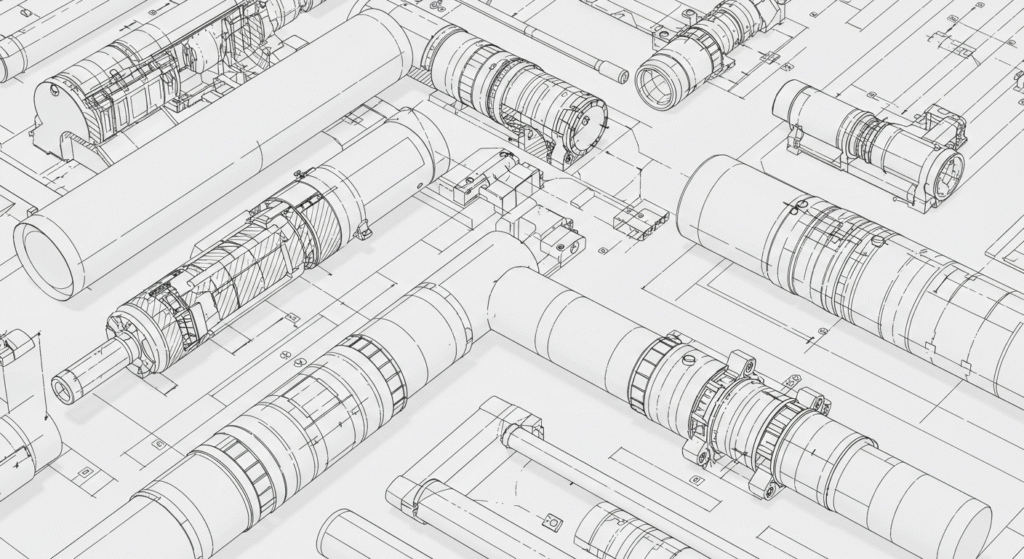
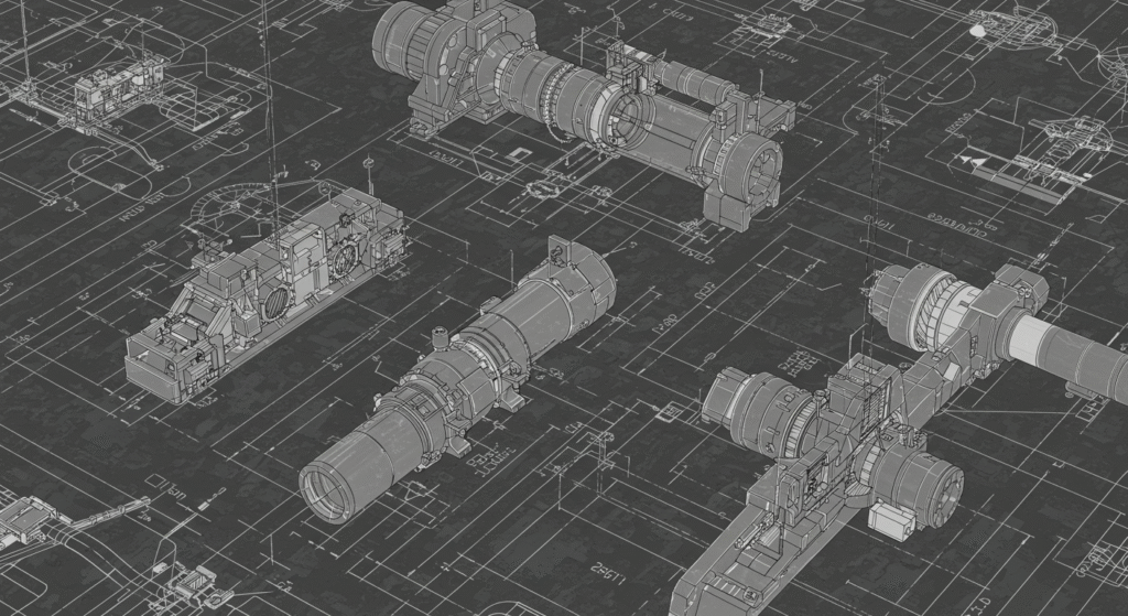
10. Shop Drawings
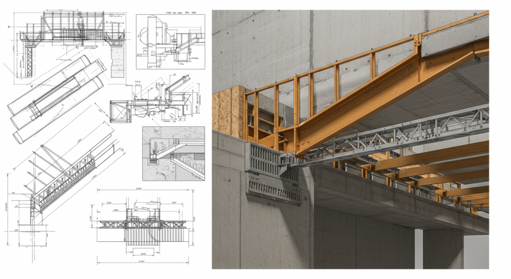
Shop drawings are detailed plans for specific components or systems that are fabricated off-site. These drawings are essential for ensuring that components are manufactured to the required specifications and can be assembled correctly on-site.
- Types of Shop Drawings:
- Steel Shop Drawings: These drawings show the details of steel components, such as beams, columns, and connections.
- Precast Concrete Drawings: These drawings show the details of precast concrete components, such as slabs, beams, and columns.
- Mechanical Shop Drawings: These drawings show the details of mechanical components, such as piping, ductwork, and equipment.
11. As-Built Drawings
As-built drawings are the final set of drawings that show the actual construction of the project. These drawings are essential for documenting the final state of the project and ensuring that all components are constructed to the required specifications.
- Types of As-Built Drawings:
- Architectural As-Built Drawings: These drawings show the final layout and design of the building, including any changes made during construction.
- Structural As-Built Drawings: These drawings show the final structural framework of the building, including any changes made during construction.
- Mechanical As-Built Drawings: These drawings show the final layout of mechanical systems, including any changes made during construction.
- Electrical As-Built Drawings: These drawings show the final layout of electrical systems, including any changes made during construction.
12. Topographic Maps

Topographic maps are detailed drawings that show the natural features of a site, including contours, elevations, and water bodies. These maps are essential for understanding the topography of the site and planning the layout of the project.
- Types of Topographic Maps:
- Contour Maps: These maps show the elevation of the site using contour lines.
- Elevation Maps: These maps show the elevation of the site using color gradients or shading.
- Hydrographic Maps: These maps show the water bodies and drainage patterns of the site.
13. Drainage Plans
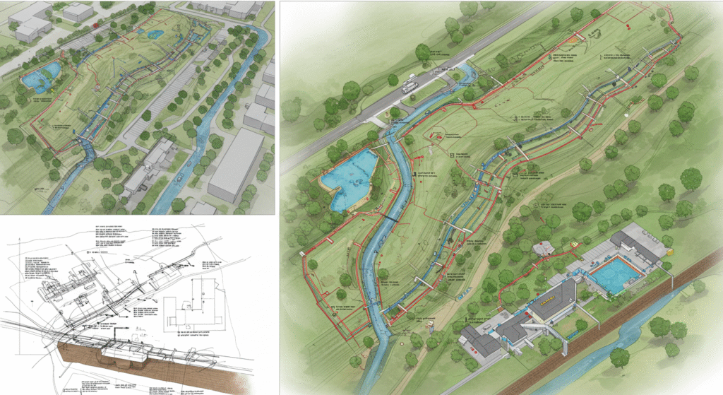
Drainage plans are detailed drawings that show the layout of the drainage system, including the location of pipes, culverts, and other drainage features. These plans are essential for ensuring that the site is properly drained and that water does not accumulate in unwanted areas.
- Types of Drainage Plans:
- Stormwater Drainage Plans: These plans show the layout of the stormwater drainage system, including the location of pipes, culverts, and catch basins.
- Sanitary Sewer Plans: These plans show the layout of the sanitary sewer system, including the location of pipes, manholes, and treatment plants.
- Water Supply Plans: These plans show the layout of the water supply system, including the location of pipes, pumps, and storage tanks.
14. Road Plans
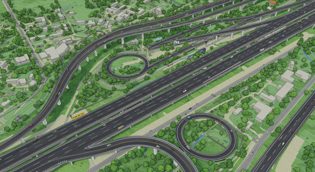
Road plans are detailed drawings that show the layout of roads, highways, and other transportation infrastructure. These plans are essential for planning and constructing transportation systems that are safe and efficient.
- Types of Road Plans:
- Alignment Plans: These plans show the horizontal and vertical alignment of the road, including the location of curves and grades.
- Cross-Sectional Plans: These plans show the cross-sectional view of the road, including the width, depth, and type of pavement.
- Drainage Plans: These plans show the layout of the drainage system along the road, including the location of culverts, catch basins, and ditches.
- Intersection Plans: These plans show the layout of intersections, including the location of traffic signals, signs, and markings.
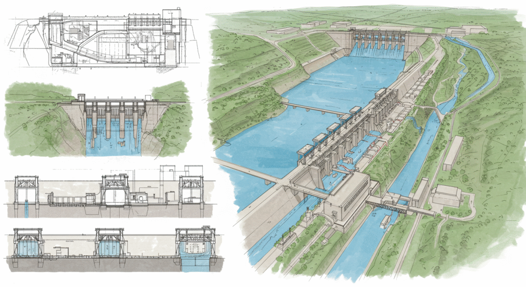
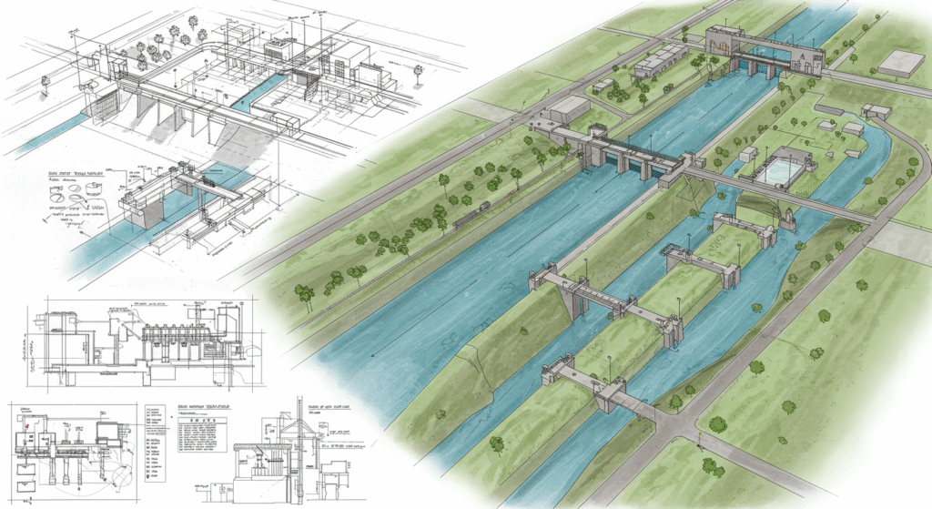
15. Bridge Plans
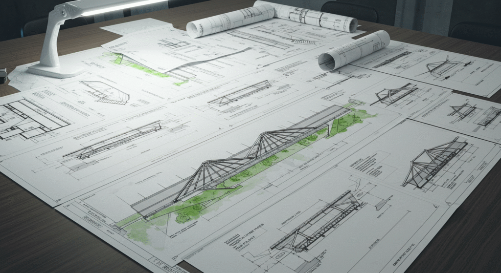
Bridge plans are detailed drawings that show the layout and design of bridges. These plans are essential for ensuring that bridges are constructed to the required specifications and that they are safe for use.
- Types of Bridge Plans:
- Elevation Plans: These plans show the front and side views of the bridge, including the location of piers, abutments, and the bridge deck.
- Cross-Sectional Plans: These plans show the cross-sectional view of the bridge, including the type of materials used and the dimensions of structural elements.
- Foundation Plans: These plans show the details of the bridge foundation, including the type of foundation, its depth, and the materials used.
- Connection Details: These plans show the details of how different structural elements are connected, such as bolts, welds, and other fasteners.
16. Survey Plans
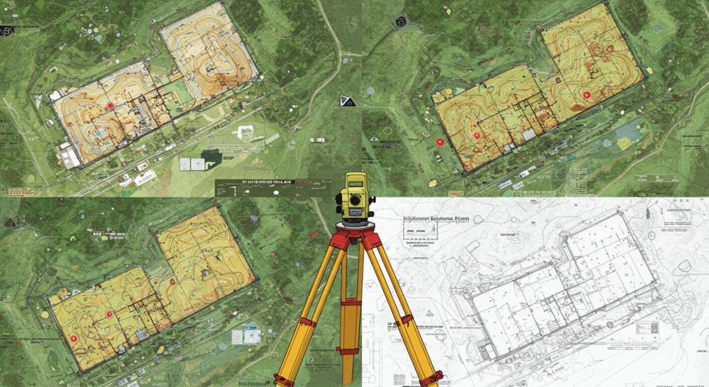
Survey plans are detailed drawings that show the results of a land survey, including the location of property boundaries, existing structures, and natural features. These plans are essential for planning and executing construction projects.
- Types of Survey Plans:
- Boundary Surveys: These plans show the location of property boundaries, including the location of monuments and markers.
- Topographic Surveys: These plans show the natural features of the site, including contours, elevations, and water bodies.
- Construction Surveys: These plans show the location of existing structures and the layout of the construction site.
- As-Built Surveys: These plans show the final location of structures and components after construction is complete.
17. Landscape Plans
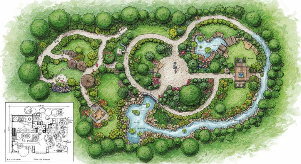
Landscape plans are detailed drawings that show the layout of landscaping features, including plants, trees, and hardscaping. These plans are essential for creating outdoor spaces that are aesthetically pleasing and functional.
- Types of Landscape Plans:
- Planting Plans: These plans show the location and type of plants and trees to be installed.
- Hardscape Plans: These plans show the layout of hardscaping features, such as walkways, patios, and retaining walls.
- Water Feature Plans: These plans show the layout of water features, such as ponds, fountains, and irrigation systems.
- Lighting Plans: These plans show the location and type of outdoor lighting fixtures to be installed.
18. Environmental Impact Assessment (EIA) Drawings
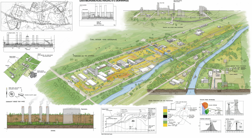
Environmental Impact Assessment (EIA) drawings are detailed drawings that show the potential environmental impacts of a project. These drawings are essential for ensuring that projects are designed and constructed in an environmentally responsible manner.
- Types of EIA Drawings:
- Land Use Maps: These maps show the current land use patterns and how they will be affected by the project.
- Habitat Maps: These maps show the location of habitats and ecosystems that may be affected by the project.
- Water Quality Maps: These maps show the potential impacts on water quality, including the location of water bodies and drainage patterns.
- Noise and Air Quality Maps: These maps show the potential impacts on noise and air quality, including the location of sources and receptors.
19. Transportation Engineering Drawings
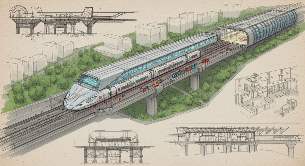
Transportation engineering drawings are detailed drawings that show the layout of transportation infrastructure, including roads, highways, bridges, and public transportation systems. These drawings are essential for planning and constructing safe and efficient transportation systems.
- Types of Transportation Engineering Drawings:
- Road Plans: These plans show the layout of roads, including the location of lanes, shoulders, and intersections.
- Bridge Plans: These plans show the layout and design of bridges, including the location of piers, abutments, and the bridge deck.
- Public Transportation Plans: These plans show the layout of public transportation systems, including the location of stations, tracks, and signals.
- Traffic Management Plans: These plans show the layout of traffic management systems, including the location of traffic signals, signs, and markings.
20. Water Resource Engineering Drawings
Water resource engineering drawings are detailed drawings that show the layout of water resource systems, including water supply, drainage, and irrigation systems. These drawings are essential for ensuring that water resources are managed efficiently and sustainably.
- Types of Water Resource Engineering Drawings:
- Water Supply Plans: These plans show the layout of the water supply system, including the location of pipes, pumps, and storage tanks.
- Drainage Plans: These plans show the layout of the drainage system, including the location of pipes, culverts, and catch basins.
- Irrigation Plans: These plans show the layout of the irrigation system, including the location of pipes, sprinklers, and valves.
- Flood Control Plans: These plans show the layout of flood control systems, including the location of levees, dams, and flood gates.
21. Geotechnical Drawings
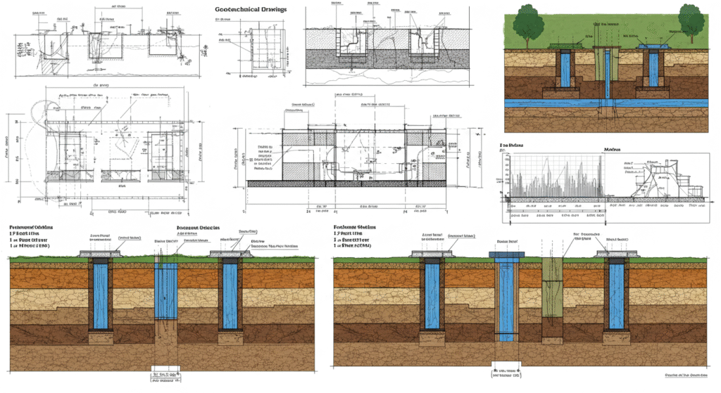
Geotechnical drawings are detailed drawings that show the geotechnical characteristics of a site, including soil types, rock formations, and groundwater levels. These drawings are essential for ensuring that structures are built on stable ground and that geological risks are mitigated.
- Types of Geotechnical Drawings:
- Soil Maps: These maps show the types and distribution of soils on the site.
- Rock Maps: These maps show the location and type of rock formations on the site.
- Groundwater Maps: These maps show the location and depth of groundwater on the site.
- Stability Analysis Drawings: These drawings show the results of stability analyses, including the location of potential landslides and other geological hazards.
22. Construction Plans

Construction plans are detailed drawings that show the layout and sequence of construction activities. These plans are essential for guiding the construction process and ensuring that the project is built according to the design specifications.
- Types of Construction Plans:
- Site Plans: These plans show the layout of the construction site, including the location of buildings, roads, and utilities.
- Construction Sequencing Plans: These plans show the sequence of construction activities, including the timing and phasing of different tasks.
- Material Management Plans: These plans show the layout and management of materials and equipment on the construction site.
- Safety Plans: These plans show the layout of safety measures and equipment on the construction site, including the location of first aid stations, fire extinguishers, and emergency exits.
23. As-Built Plans
As-built plans are the final set of drawings that show the actual construction of the project. These plans are essential for documenting the final state of the project and ensuring that all components are constructed to the required specifications.
- Types of As-Built Plans:
- Architectural As-Built Plans: These plans show the final layout and design of the building, including any changes made during construction.
- Structural As-Built Plans: These plans show the final structural framework of the building, including any changes made during construction.
- Mechanical As-Built Plans: These plans show the final layout of mechanical systems, including any changes made during construction.
- Electrical As-Built Plans: These plans show the final layout of electrical systems, including any changes made during construction.
24. Demolition Plans

Demolition plans are detailed drawings that show the sequence and methods for demolishing existing structures. These plans are essential for ensuring that demolition activities are carried out safely and efficiently.
- Types of Demolition Plans:
- Demolition Sequencing Plans: These plans show the sequence of demolition activities, including the order in which structures are to be demolished.
- Structural Analysis Plans: These plans show the structural analysis of the building, including the location of load-bearing walls and columns.
- Safety Plans: These plans show the layout of safety measures during demolition, including the location of scaffolding, netting, and other safety equipment.
- Material Management Plans: These plans show the layout and management of materials and debris during demolition.
25. Renovation and Retrofit Plans
Renovation and retrofit plans are detailed drawings that show the layout and design of renovation and retrofit projects. These plans are essential for ensuring that existing structures are updated and improved while maintaining their structural integrity.
- Types of Renovation and Retrofit Plans:
- Existing Condition Plans: These plans show the current condition of the building, including the location of structural elements and systems.
- Proposed Renovation Plans: These plans show the proposed layout and design of the renovation, including the location of new walls, doors, and windows.
- Structural Retrofit Plans: These plans show the details of structural retrofitting, including the location of reinforcement and other structural upgrades.
- System Upgrade Plans: These plans show the details of system upgrades, including the location of new mechanical, electrical, and plumbing systems.
26. Green Building Plans
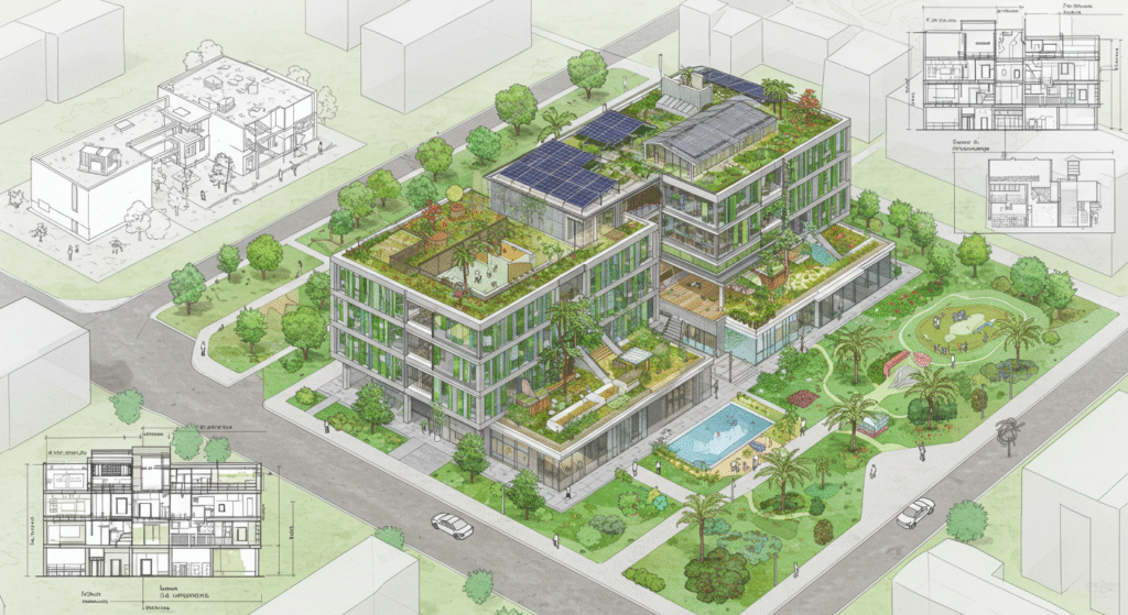
Green building plans are detailed drawings that show the layout and design of green building projects. These plans are essential for ensuring that buildings are designed and constructed in an environmentally responsible manner, minimizing their impact on the environment.
- Types of Green Building Plans:
- Energy Efficiency Plans: These plans show the layout and design of energy-efficient systems, including the location of insulation, windows, and renewable energy systems.
- Water Conservation Plans: These plans show the layout and design of water conservation systems, including the location of low-flow fixtures and rainwater harvesting systems.
- Sustainable Material Plans: These plans show the location and type of sustainable materials used in the construction of the building.
- Indoor Air Quality Plans: These plans show the layout and design of systems that improve indoor air quality, including the location of ventilation systems and air filters.
27. Smart Building Plans
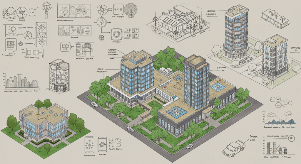
Smart building plans are detailed drawings that show the layout and design of smart building systems. These plans are essential for ensuring that buildings are equipped with advanced technologies that improve energy efficiency, security, and occupant comfort.
- Types of Smart Building Plans:
- Building Automation Systems (BAS) Plans: These plans show the layout and design of building automation systems, including the location of sensors, controllers, and other devices.
- Energy Management Systems (EMS) Plans: These plans show the layout and design of energy management systems, including the location of smart meters and energy-efficient devices.
- Security Systems Plans: These plans show the layout and design of security systems, including the location of cameras, alarms, and access control systems.
- Telecommunications Plans: These plans show the layout and design of telecommunications systems, including the location of data cabling, wireless access points, and other networking equipment.
28. Disaster Recovery and Emergency Response Plans

Disaster recovery and emergency response plans are detailed drawings that show the layout and design of systems and procedures for responding to and recovering from natural disasters and other emergencies. These plans are essential for ensuring that buildings and communities are prepared for and can respond to emergencies effectively.
- Types of Disaster Recovery and Emergency Response Plans:
- Emergency Evacuation Plans: These plans show the layout of emergency evacuation routes, including the location of exits, stairwells, and assembly points.
- Fire Safety Plans: These plans show the layout of fire safety systems, including the location of fire extinguishers, fire alarms, and sprinkler systems.
- Flood Protection Plans: These plans show the layout and design of flood protection systems, including the location of levees, flood gates, and other protective measures.
- Earthquake Retrofit Plans: These plans show the details of earthquake retrofitting, including the location of structural reinforcements and other seismic upgrades.
29. Urban Planning and Development Plans
Urban planning and development plans are detailed drawings that show the layout and design of urban areas, including the location of buildings, roads, parks, and other public spaces. These plans are essential for creating livable and sustainable cities.
- Types of Urban Planning and Development Plans:
- Master Plans: These plans show the overall layout and design of the urban area, including the location of different land uses, transportation systems, and public facilities.
- Zoning Plans: These plans show the location of different zoning districts, including the types of land uses allowed in each area.
- Transportation Plans: These plans show the layout of transportation systems, including the location of roads, public transportation routes, and pedestrian and cycling paths.
- Land Use Plans: These plans show the location of different land uses, including residential, commercial, industrial, and recreational areas.
30. Geographic Information Systems (GIS) Plans
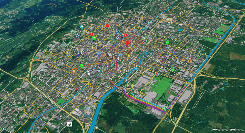
Geographic Information Systems (GIS) plans are detailed drawings that show the spatial relationships between different features and data. These plans are essential for analyzing and managing geographic data, and for making informed decisions about land use, transportation, and other urban planning issues.
- Types of GIS Plans:
- Mapping Plans: These plans show the spatial relationships between different features, including the location of buildings, roads, and natural features.
- Data Analysis Plans: These plans show the results of spatial data analysis, including the location of patterns, trends, and relationships.
- Planning and Design Plans: These plans show the layout and design of proposed developments, including the location of buildings, roads, and other infrastructure.
- Environmental Plans: These plans show the location of environmental features, including the location of habitats, water bodies, and other ecosystems.
31. 3D Modeling and Building Information Modeling (BIM)
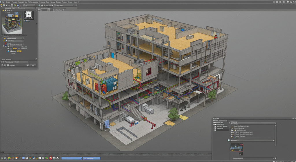
3D modeling and Building Information Modeling (BIM) are advanced technologies used in civil engineering to create detailed digital models of buildings and infrastructure. These models are essential for improving the design, construction, and operation of buildings, and for enhancing collaboration and coordination among stakeholders.
- Types of 3D Modeling and BIM:
- Architectural Models: These models show the detailed design of buildings, including the layout of rooms, walls, windows, and other architectural features.
- Structural Models: These models show the detailed design of structural elements, including beams, columns, and foundations.
- Mechanical Models: These models show the detailed design of mechanical systems, including ductwork, piping, and equipment.
- Electrical Models: These models show the detailed design of electrical systems, including wiring, circuits, and other electrical components.
- Plumbing Models: These models show the detailed design of plumbing systems, including pipes, fixtures, and other plumbing components.
32. Virtual Reality (VR) and Augmented Reality (AR) Drawings

Virtual Reality (VR) and Augmented Reality (AR) are advanced technologies used in civil engineering to create immersive and interactive visualizations of buildings and infrastructure. These technologies are essential for enhancing the design and construction process, and for improving communication and collaboration among stakeholders.
- Types of VR and AR Drawings:
- Architectural Visualizations: These visualizations show the detailed design of buildings and other structures in a realistic and immersive environment.
- Structural Visualizations: These visualizations show the detailed design of structural elements, including beams, columns, and foundations, in a realistic and immersive environment.
- Mechanical Visualizations: These visualizations show the detailed design of mechanical systems, including ductwork, piping, and equipment, in a realistic and immersive environment.
- Electrical Visualizations: These visualizations show the detailed design of electrical systems, including wiring, circuits, and other electrical components, in a realistic and immersive environment.
33. Unmanned Aerial Vehicle (UAV) and Drone Mapping
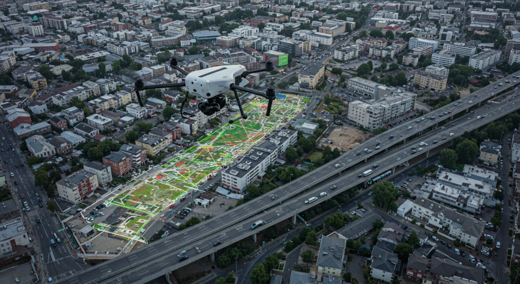
Unmanned Aerial Vehicle (UAV) and drone mapping are advanced technologies used in civil engineering to create detailed maps and visualizations of construction sites and infrastructure. These technologies are essential for improving the accuracy and efficiency of site surveys, and for monitoring the progress of construction projects.
- Types of UAV and Drone Mapping:
- Topographic Mapping: These maps show the detailed topography of the site, including contours, elevations, and water bodies.
- Progress Monitoring: These visualizations show the progress of construction activities, including the location of completed and ongoing work.
- Structural Inspections: These visualizations show the detailed inspection of structural elements, including the location of cracks, damage, and other defects.
- Environmental Monitoring: These visualizations show the detailed monitoring of environmental features, including the location of habitats, water bodies, and other ecosystems.
34. Laser Scanning and Point Cloud Drawings
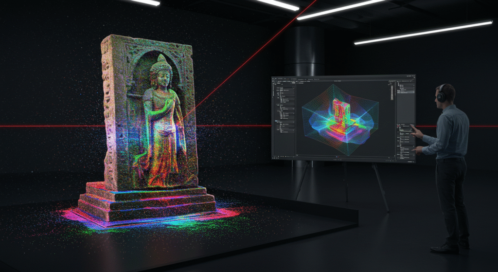
Laser scanning and point cloud drawings are advanced technologies used in civil engineering to create detailed three-dimensional models of buildings and infrastructure. These models are essential for improving the accuracy and efficiency of design and construction, and for enhancing collaboration and coordination among stakeholders.
- Types of Laser Scanning and Point Cloud Drawings:
- Architectural Models: These models show the detailed design of buildings, including the layout of rooms, walls, windows, and other architectural features.
- Structural Models: These models show the detailed design of structural elements, including beams, columns, and foundations.
- Mechanical Models: These models show the detailed design of mechanical systems, including ductwork, piping, and equipment.
- Electrical Models: These models show the detailed design of electrical systems, including wiring, circuits, and other electrical components.
35. Sustainable and Resilient Infrastructure Plans
Sustainable and resilient infrastructure plans are detailed drawings that show the layout and design of infrastructure projects that are designed to be environmentally sustainable and resilient to natural disasters and other disruptions. These plans are essential for creating infrastructure that minimizes its impact on the environment and that can withstand and recover from disruptions.
- Types of Sustainable and Resilient Infrastructure Plans:
- Green Infrastructure Plans: These plans show the layout and design of green infrastructure, including the location of green roofs, rain gardens, and other sustainable features.
- Resilient Infrastructure Plans: These plans show the layout and design of resilient infrastructure, including the location of levees, flood gates, and other protective measures.
- Renewable Energy Plans: These plans show the layout and design of renewable energy systems, including the location of solar panels, wind turbines, and other renewable energy technologies.
- Water Management Plans: These plans show the layout and design of water management systems, including the location of rainwater harvesting systems, greywater systems, and other water conservation measures.
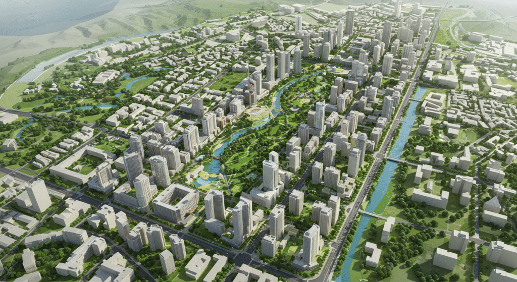
36. Smart City Plans

Smart city plans are detailed drawings that show the layout and design of smart city projects, including the integration of advanced technologies into urban infrastructure. These plans are essential for creating cities that are more efficient, sustainable, and livable.
- Types of Smart City Plans:
- IoT (Internet of Things) Plans: These plans show the layout and design of IoT systems, including the location of sensors, smart meters, and other connected devices.
- Smart Grid Plans: These plans show the layout and design of smart grid systems, including the location of smart meters, renewable energy sources, and other advanced technologies.
- Smart Transportation Plans: These plans show the layout and design of smart transportation systems, including the location of intelligent traffic management systems, public transportation routes, and other advanced transportation technologies.
- Smart Building Plans: These plans show the layout and design of smart buildings, including the location of building automation systems, energy management systems, and other advanced technologies.
37. Flood Risk Management Plans
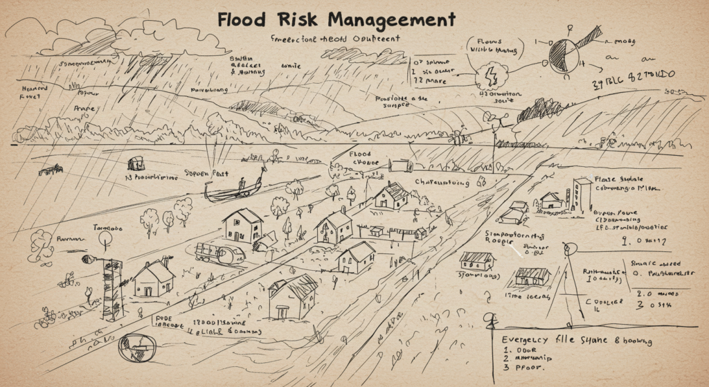
Flood risk management plans are detailed drawings that show the layout and design of systems and measures for managing and mitigating flood risks. These plans are essential for protecting communities and infrastructure from the impacts of flooding.
- Types of Flood Risk Management Plans:
- Flood Mapping Plans: These plans show the location of flood-prone areas, including the extent of flood zones and the potential impacts of flooding.
- Levee and Dam Plans: These plans show the layout and design of levees and dams, including the location of these structures and their design specifications.
- Flood Gate and Barrier Plans: These plans show the layout and design of flood gates and barriers, including the location of these structures and their design specifications.
- Wetland and Natural Floodplain Management Plans: These plans show the layout and design of wetland and natural floodplain management systems, including the location of habitats and ecosystems that help to mitigate flood risks.
38. Earthquake-Resistant Design Plans
Earthquake-resistant design plans are detailed drawings that show the layout and design of structures that are designed to withstand earthquakes. These plans are essential for ensuring that buildings and infrastructure can resist the forces generated by earthquakes and that they can be safely occupied after an earthquake.
- Types of Earthquake-Resistant Design Plans:
- Structural Design Plans: These plans show the layout and design of structural elements, including beams, columns, and foundations, that are designed to resist seismic forces.
- Bracing and Support Plans: These plans show the layout and design of bracing and support systems, including the location of cross-bracing, shear walls, and other structural elements that provide stability during earthquakes.
- Seismic Isolation Plans: These plans show the layout and design of seismic isolation systems, including the location of isolation bearings and other devices that decouple the building from ground motion.
- Energy Dissipation Plans: These plans show the layout and design of energy dissipation systems, including the location of shock absorbers, dampers, and other devices that help to dissipate seismic energy.
39. Wind-Resistant Design Plans
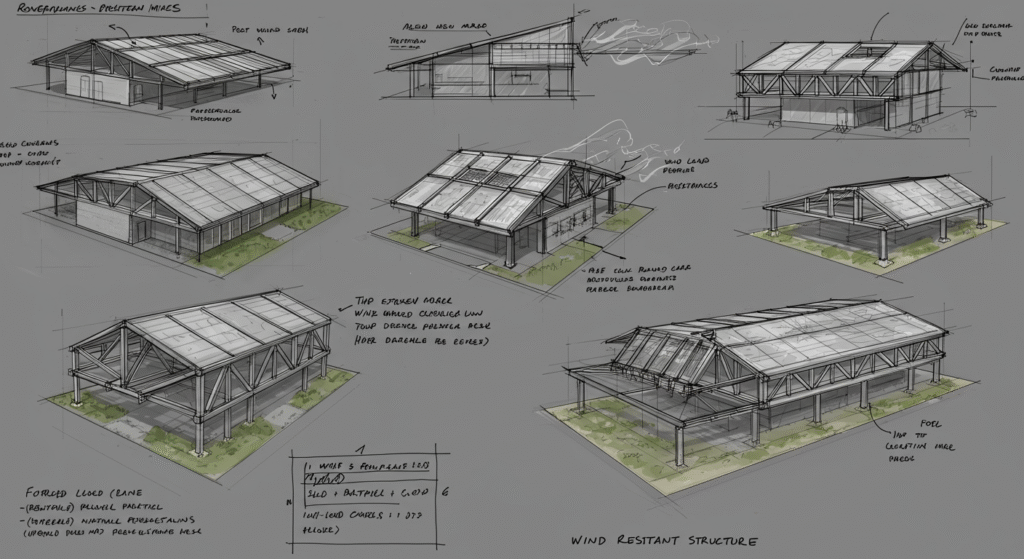
Wind-resistant design plans are detailed drawings that show the layout and design of structures that are designed to withstand wind forces. These plans are essential for ensuring that buildings and infrastructure can resist the forces generated by windstorms and that they can be safely occupied after a storm.
- Types of Wind-Resistant Design Plans:
- Structural Design Plans: These plans show the layout and design of structural elements, including beams, columns, and foundations, that are designed to resist wind forces.
- Cladding and Facade Plans: These plans show the layout and design of cladding and facade systems, including the location of windows, doors, and other exterior components that are designed to resist wind forces.
- Roofing Plans: These plans show the layout and design of roofing systems, including the location of roofing materials, fasteners, and other components that are designed to resist wind uplift and other wind-related forces.
- Aerodynamic Plans: These plans show the layout and design of aerodynamic features, including the location of wind breaks, spoilers, and other devices that help to reduce wind forces on the structure.
40. Fire-Resistant Design Plans
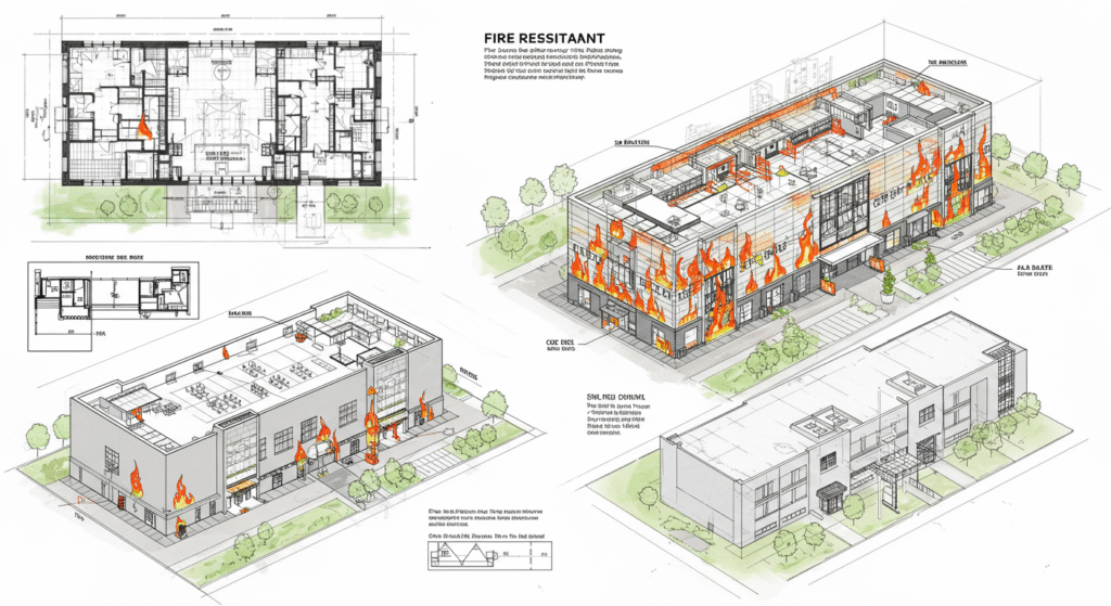
Fire-resistant design plans are detailed drawings that show the layout and design of structures that are designed to withstand fire. These plans are essential for ensuring that buildings and infrastructure can resist the spread of fire and that they can be safely evacuated and occupied after a fire.
- Types of Fire-Resistant Design Plans:
- Structural Design Plans: These plans show the layout and design of structural elements, including beams, columns, and foundations, that are designed to resist fire.
- Fire-Resistant Materials Plans: These plans show the location and type of fire-resistant materials used in the construction of the building, including fire-resistant insulation, drywall, and other materials.
- Fire Suppression Systems Plans: These plans show the layout and design of fire suppression systems, including the location of sprinklers, fire alarms, and other fire safety equipment.
- Evacuation Plans: These plans show the layout of emergency evacuation routes, including the location of exits, stairwells, and other means of egress.
41. Acoustic Design Plans
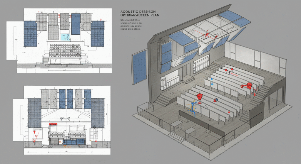
Acoustic design plans are detailed drawings that show the layout and design of systems and measures for controlling and managing sound in buildings and other structures. These plans are essential for creating spaces that are acoustically pleasant and functional, and for minimizing noise pollution.
- Types of Acoustic Design Plans:
- Sound Insulation Plans: These plans show the layout and design of sound insulation systems, including the location of acoustic insulation materials, soundproof walls, and other noise-reducing features.
- Acoustic Panel Plans: These plans show the layout and design of acoustic panels and other sound-absorbing materials, including their location and type.
- Noise Reduction Plans: These plans show the layout and design of systems and measures for reducing noise, including the location of sound barriers, mufflers, and other noise-reducing devices.
- Audio System Plans: These plans show the layout and design of audio systems, including the location of speakers, amplifiers, and other audio equipment.
42. Lighting Design Plans
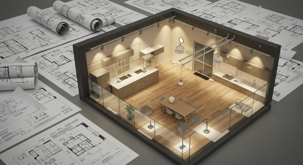
Lighting design plans are detailed drawings that show the layout and design of lighting systems in buildings and other structures. These plans are essential for creating spaces that are well-lit, energy-efficient, and visually appealing.
- Types of Lighting Design Plans:
- Architectural Lighting Plans: These plans show the layout and design of lighting systems that are integrated into the architecture of the building, including the location of recessed lights, sconces, and other lighting fixtures.
- Task Lighting Plans: These plans show the layout and design of lighting systems that are designed for specific tasks, including the location of desk lamps, under-cabinet lighting, and other task-oriented lighting fixtures.
- Ambient Lighting Plans: These plans show the layout and design of lighting systems that create a general, uniform level of illumination in a space, including the location of ceiling-mounted fixtures and other ambient lighting sources.
- Energy-Efficient Lighting Plans: These plans show the layout and design of energy-efficient lighting systems, including the location of LED lights, motion sensors, and other energy-saving lighting technologies.
43. Landscape Lighting Plans

Landscape lighting plans are detailed drawings that show the layout and design of lighting systems for outdoor spaces, including parks, gardens, and other public areas. These plans are essential for creating visually appealing and functional outdoor spaces that are well-lit and safe.
- Types of Landscape Lighting Plans:
- Architectural Lighting Plans: These plans show the layout and design of lighting systems that highlight the architectural features of outdoor spaces, including the location of uplights, downlights, and other lighting fixtures.
- Pathway Lighting Plans: These plans show the layout and design of lighting systems that illuminate walkways, paths, and other pedestrian routes, including the location of bollards, in-ground lights, and other lighting fixtures.
- Security Lighting Plans: These plans show the layout and design of lighting systems that provide security and deter criminal activity, including the location of floodlights, motion-activated lights, and other security lighting fixtures.
- Energy-Efficient Lighting Plans: These plans show the layout and design of energy-efficient lighting systems, including the location of LED lights, solar-powered lights, and other energy-saving lighting technologies.
44. Water Feature Design Plans
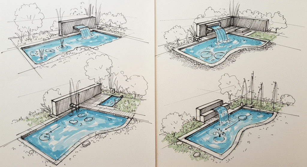
Water feature design plans are detailed drawings that show the layout and design of water features, including ponds, fountains, and other water-related elements. These plans are essential for creating visually appealing and functional water features that enhance the aesthetic and recreational value of outdoor spaces.
- Types of Water Feature Design Plans:
- Pond Design Plans: These plans show the layout and design of ponds, including the location of liners, pumps, and other components necessary for maintaining water quality and circulation.
- Fountain Design Plans: These plans show the layout and design of fountains, including the location of pumps, jets, and other components necessary for creating decorative water displays.
- Stream and River Design Plans: These plans show the layout and design of streams and rivers, including the location of channels, waterfalls, and other features that create a natural and visually appealing watercourse.
- Irrigation Design Plans: These plans show the layout and design of irrigation systems, including the location of sprinklers, drip irrigation lines, and other components necessary for efficiently watering plants and landscapes.
45. Playground and Recreation Design Plans
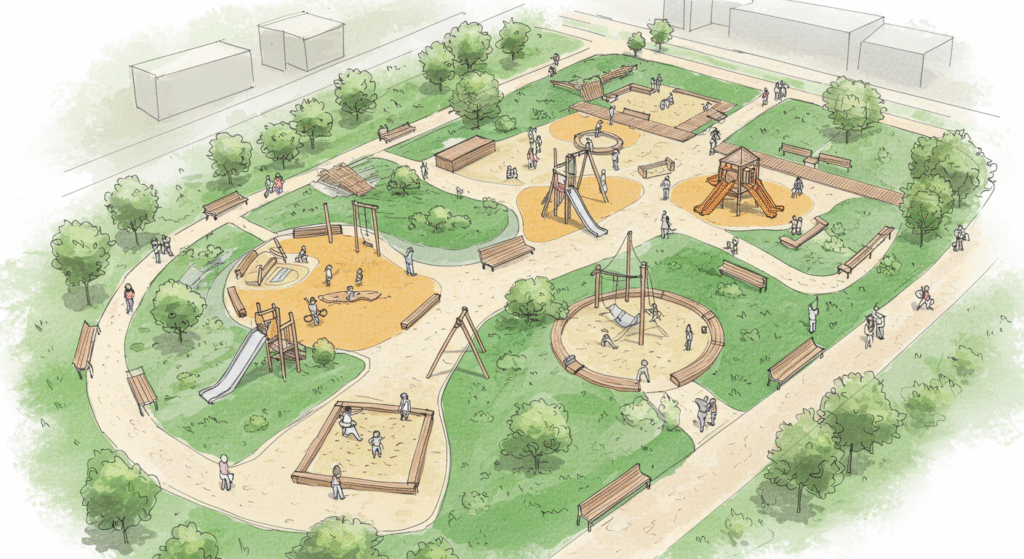
Playground and recreation design plans are detailed drawings that show the layout and design of playgrounds, parks, and other recreational spaces. These plans are essential for creating safe, functional, and enjoyable outdoor spaces that promote physical activity, social interaction, and community engagement.
- Types of Playground and Recreation Design Plans:
- Play Equipment Layout Plans: These plans show the layout and design of playground equipment, including the location of swings, slides, climbing structures, and other play elements.
- Sports Field Design Plans: These plans show the layout and design of sports fields, including the location of soccer fields, basketball courts, and other athletic facilities.
- Picnic and Seating Area Plans: These plans show the layout and design of picnic areas and seating spaces, including the location of benches, tables, and other amenities.
- Walking and Cycling Path Plans: These plans show the layout and design of walking and cycling paths, including the location of trails, bike lanes, and other infrastructure that supports active transportation.
46. Parking and Transportation Design Plans
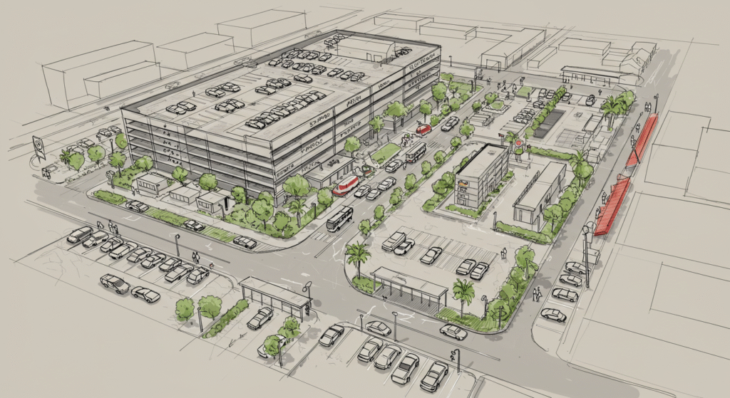
Parking and transportation design plans are detailed drawings that show the layout and design of parking lots, garages, and other transportation-related infrastructure. These plans are essential for creating safe, efficient, and accessible parking and transportation systems that support the needs of drivers, pedestrians, and cyclists.
- Types of Parking and Transportation Design Plans:
- Parking Lot Design Plans: These plans show the layout and design of parking lots, including the location of parking spaces, driveways, and other infrastructure.
- Garage Design Plans: These plans show the layout and design of parking garages, including the location of parking levels, ramps, and other structural elements.
- Public Transportation Plans: These plans show the layout and design of public transportation systems, including the location of bus stops, train stations, and other transit facilities.
- Bike Parking and Storage Plans: These plans show the layout and design of bike parking and storage facilities, including the location of bike racks, lockers, and other amenities.
47. Signage and Wayfinding Design Plans
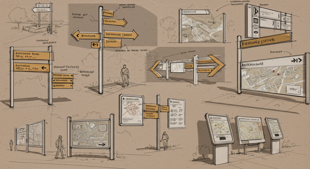
Signage and wayfinding design plans are detailed drawings that show the layout and design of signs and other wayfinding elements in buildings and public spaces. These plans are essential for creating clear and effective signage that helps people navigate and find their way around.
- Types of Signage and Wayfinding Design Plans:
- Architectural Signage Plans: These plans show the layout and design of signs that are integrated into the architecture of the building, including the location of building directories, room signs, and other wayfinding elements.
- Directional Signage Plans: These plans show the layout and design of signs that provide directional information, including the location of arrows, maps, and other guidance elements.
- Informational Signage Plans: These plans show the layout and design of signs that provide informational content, including the location of informational kiosks, bulletin boards, and other communication elements.
- Branding and Identity Signage Plans: These plans show the layout and design of signs that reflect the brand and identity of the organization, including the location of logos, corporate colors, and other visual elements.
48. Accessibility and Universal Design Plans
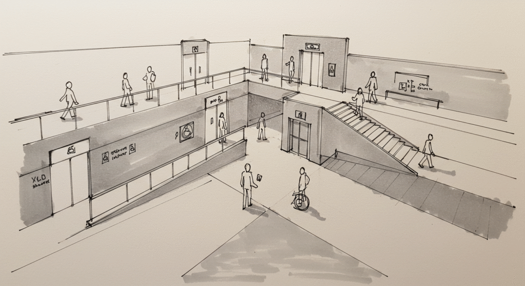
Accessibility and universal design plans are detailed drawings that show the layout and design of buildings and public spaces to ensure that they are accessible and usable by everyone, including people with disabilities. These plans are essential for creating inclusive and equitable environments that promote social participation and independence.
- Types of Accessibility and Universal Design Plans:
- Wheelchair Accessibility Plans: These plans show the layout and design of ramps, elevators, and other accessibility features that enable wheelchair users to navigate the space.
- Clearance and Reach Plans: These plans show the layout and design of spaces to ensure that there is adequate clearance for wheelchairs and that essential elements, such as light switches and door handles, are within reach.
- Auditory and Visual Accessibility Plans: These plans show the layout and design of auditory and visual accessibility features, including the location of audio loops, visual alarms, and other elements that enhance accessibility for people with hearing or visual impairments.
- Universal Design Plans: These plans show the layout and design of spaces that incorporate universal design principles, including flexible and adaptable spaces that can be used by everyone, regardless of age or ability.
49. Emergency Shelter and Disaster Relief Design Plans
Emergency shelter and disaster relief design plans are detailed drawings that show the layout and design of temporary shelters and other facilities that provide refuge and support during emergencies and disasters. These plans are essential for creating safe and functional spaces that meet the needs of people affected by crises.
- Types of Emergency Shelter and Disaster Relief Design Plans:
- Temporary Shelter Design Plans: These plans show the layout and design of temporary shelters, including the location of sleeping areas, sanitation facilities, and other essential amenities.
- Relief Distribution Plans: These plans show the layout and design of facilities for distributing food, water, and other essential supplies during emergencies.
- Medical Facility Design Plans: These plans show the layout and design of temporary medical facilities, including the location of treatment areas, triage zones, and other healthcare spaces.
- Communication and Coordination Plans: These plans show the layout and design of communication and coordination systems, including the location of command centers, communication networks, and other infrastructure that supports emergency response and disaster relief efforts.
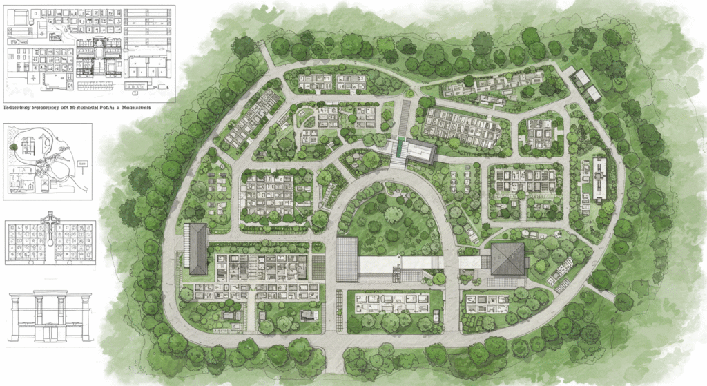
50. Cemetery and Memorial Design Plans
Cemetery and memorial design plans are detailed drawings that show the layout and design of cemeteries and memorials. These plans are essential for creating spaces that honor the deceased, provide comfort to the bereaved, and reflect the cultural and historical values of the community.
- Types of Cemetery and Memorial Design Plans:
- Grave Site Design Plans: These plans show the layout and design of individual and family grave sites, including the location of headstones, markers, and other memorials.
- Cemetery Layout Plans: These plans show the overall layout of the cemetery, including the location of different sections, roads, and other infrastructure.
- Memorial Design Plans: These plans show the layout and design of memorials, including the location of statues, plaques, and other commemorative elements.
- Landscape and Horticultural Plans: These plans show the layout and design of landscaping and horticultural features, including the location of plants, trees, and other elements that create a peaceful and contemplative environment.
Conclusion
In conclusion, the various types of drawings in civil engineering are essential for the successful planning, design, and construction of infrastructure projects. From architectural and structural drawings to mechanical, electrical, and plumbing drawings, each type of drawing plays a critical role in ensuring that projects are built to the required specifications and that they meet the needs of the community. As civil engineering continues to evolve, the use of advanced technologies such as Building Information Modeling (BIM), 3D modeling, and Geographic Information Systems (GIS) will further enhance the accuracy, efficiency, and effectiveness of civil engineering drawings. By understanding the different types of drawings and their applications, civil engineers can create comprehensive and detailed plans that guide the construction process and ensure the successful completion of projects.
- https://worldcivilsociety.com/which-engineer-makes-the-most-money/
- https://worldcivilsociety.com/the-top-10-branches-of-engineering-a-comprehensive-overview/
- https://worldcivilsociety.com/what-do-engineers-do-a-comprehensive-overview/
- https://worldcivilsociety.com/which-engineering-course-is-best-a-comprehensive-guide/