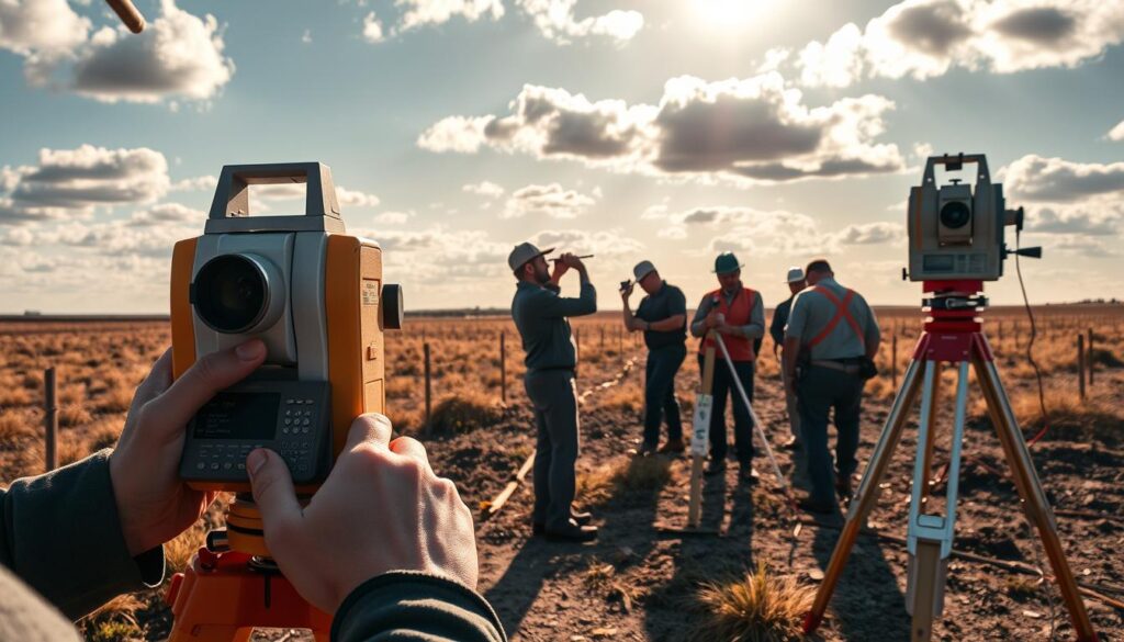
Did you know that inaccurate land measurements can lead to costly construction delays and even project failures? Accurate land surveying is crucial for the success of civil engineering projects.
Land surveying involves measuring and mapping out land areas to determine distances, angles, contours, and elevations between multiple points on the Earth’s surface. This data is essential for construction projects, enabling accurate measurements and informed decision-making.
Key Takeaways
- Accurate land surveying is vital for civil engineering project success.
- Land surveying involves measuring and mapping land areas.
- Surveying data informs construction project decisions.
- Inaccurate measurements can lead to costly delays and project failures.
- Surveying techniques ensure accurate land measurements.
Introduction to Surveying in Civil Engineering
In civil engineering, surveying is fundamental as it verifies that construction adheres to the predetermined plans and specifications. Surveying ensures that construction aligns with design specifications and takes into consideration the natural features, boundaries, and legal property lines.
What is Surveying?
Surveying is the process of determining the positions of points on the Earth’s surface. It involves measuring distances, angles, and heights to establish property boundaries, determine topography, and layout construction projects. Construction surveying is a critical aspect of this process, as it ensures that the construction project is built according to the planned specifications.
For a deeper understanding of the role of surveying in civil engineering, you can explore more resources, such as the article on surveying in civil engineering, which provides comprehensive insights into the field.
Importance of Surveying in Construction
The importance of surveying in construction cannot be overstated. It is essential for ensuring that projects are executed according to plan, taking into account natural features and legal boundaries. Geodetic surveying plays a crucial role in this process by providing accurate spatial data that is used to determine the layout of the project.
Surveying helps in identifying potential issues early on, such as discrepancies in property lines or unforeseen topographical challenges. By addressing these issues at the outset, surveying contributes to the smooth execution of construction projects, ultimately saving time and resources.
Types of Surveying Techniques

The field of surveying encompasses a range of techniques, each with its unique applications and significance in civil engineering projects. Surveying techniques are crucial for gathering accurate data, which is then used for planning, designing, and executing construction projects.
Land Surveying
Land surveying focuses on measuring and mapping terrestrial areas to support construction, property development, and landscape planning. It involves determining property boundaries, identifying existing features, and providing data for infrastructure development. Accurate land surveying is essential for preventing legal disputes over property lines and ensuring that construction projects are executed on the correct sites.
Topographic Surveying
Topographic surveying is concerned with mapping the contours and features of the land surface. This type of survey is vital for understanding the terrain’s characteristics, including elevations, depressions, and natural features like rivers or slopes. Topographic surveys are used extensively in the planning stages of construction projects to assess the feasibility of the terrain and to design the project layout. By providing detailed information about the land’s surface, topographic surveying aids in the creation of accurate and effective project designs.
Both land and topographic surveying are foundational to the success of civil engineering projects. They provide the necessary data for project planning, design, and execution, ensuring that projects are completed on time, within budget, and to the required specifications.
The Role of Technology in Surveying
The advent of advanced technologies has revolutionized the field of surveying, enhancing accuracy and efficiency. Modern surveying relies heavily on innovative tools and software to deliver precise results.
GPS and GNSS in Modern Surveying
GPS technology determines the precise coordinates of a point on the Earth’s surface, playing a critical role in surveying techniques. The use of GPS and GNSS has significantly improved the accuracy of surveys, allowing for real-time data collection and analysis.
Laser Scanning and Digital Photogrammetry
Laser scanning and digital photogrammetry create detailed 3D models and maps, enhancing the understanding of complex terrains. These technologies enable surveyors to capture comprehensive data, which can be used in various applications, including construction and urban planning.
| Technology | Application | Benefits |
|---|---|---|
| GPS/GNSS | Precise coordinate determination | Improved accuracy, real-time data |
| Laser Scanning | 3D modeling | Detailed terrain representation |
| Digital Photogrammetry | 3D mapping | Comprehensive data capture |
The Impact of Drones
Drones have transformed the surveying landscape by providing aerial data collection capabilities. They are equipped with various sensors and cameras, enabling the creation of detailed topographic maps and models. For more information on the impact of new technologies on surveying, visit this resource.
By integrating these advanced technologies, surveying has become more efficient, accurate, and cost-effective. The use of surveying software further enhances the analysis and presentation of data, facilitating better decision-making in various projects.
Tools and Equipment for Surveying

The precision required in surveying is made possible by an array of sophisticated instruments and technologies. Surveying equipment has evolved significantly over the years, from simple measuring tapes to complex electronic devices.
Total Stations
Total stations are among the most versatile tools used in surveying. They combine the functions of an electronic theodolite and an electronic distance measuring device, allowing surveyors to measure angles and distances simultaneously. This integration significantly enhances the efficiency and accuracy of surveying tasks. For a comprehensive overview of instruments used in civil engineering, including those in surveying, visit this resource.
Key Features of Total Stations:
- Electronic angle measurement
- Distance measurement capabilities
- Data recording and transfer
Levels and Theodolites
Levels and theodolites are fundamental instruments in surveying. Levels are used to determine the difference in height between two points, while theodolites measure angles between reference points. These instruments are crucial for establishing accurate reference points in construction and topographic surveys.
| Instrument | Primary Function | Application |
|---|---|---|
| Levels | Measure height differences | Establishing reference heights |
| Theodolites | Measure angles | Determining spatial relationships |
Measuring Tapes and Markers
Measuring tapes and markers are simple yet essential tools in surveying. Measuring tapes are used for direct distance measurements, while markers are used to identify reference points. These tools are indispensable for preliminary surveys and for verifying measurements taken with more sophisticated equipment.
The accuracy of these basic tools can significantly impact the overall accuracy of a survey.
Surveying Process Overview
Surveying in civil engineering involves a meticulous process that includes measuring distances, angles, and elevations to create detailed maps and plans. This process is fundamental to construction surveying, ensuring that projects are executed accurately and efficiently.
The surveying process begins with thorough planning and preparation, including determining the scope of the project and the techniques to be used. Geodetic surveying plays a crucial role in this phase, providing the reference points necessary for subsequent measurements.
The next step involves conducting the actual survey, which may include using various tools and equipment such as total stations, GPS receivers, and leveling instruments. The data collected during this phase is then processed and analyzed to create detailed maps and plans.
To illustrate the steps involved in the surveying process, consider the following table:
| Step | Description | Tools/Equipment |
|---|---|---|
| 1. Planning | Determining project scope and techniques | None |
| 2. Data Collection | Measuring distances, angles, and elevations | Total Stations, GPS, Leveling Instruments |
| 3. Data Analysis | Processing and analyzing collected data | Software (e.g., CAD, GIS) |
| 4. Mapping | Creating detailed maps and plans | Software (e.g., CAD, GIS) |
The final step involves presenting the findings in a clear and understandable format, often using maps, plans, and reports. Accurate construction surveying is critical to the success of civil engineering projects, ensuring that they are completed on time, within budget, and to the required specifications.
Legal Aspects of Surveying

Understanding the legal aspects of surveying is essential for resolving property boundary issues and navigating easements. Surveying plays a pivotal role in determining property boundaries, which is crucial for construction projects and resolving disputes between landowners.
Property Boundary Issues
Property boundary issues are a common challenge in land development and construction. Accurate surveying is vital to determine the exact boundaries of a property, helping to prevent encroachments and disputes with neighbors. Surveyors use various surveying techniques, including topographic surveying, to map out the land and identify any potential issues.
“The importance of accurate boundary determination cannot be overstated. It is the foundation upon which all construction and development activities are built.”
In many cases, property boundary disputes arise due to misunderstandings or lack of clear demarcation. Surveyors help resolve these disputes by providing precise measurements and documentation that can be used in legal proceedings if necessary.
| Issue | Description | Surveying Solution |
|---|---|---|
| Boundary Disputes | Disagreements between neighbors about property lines. | Accurate boundary surveying to determine exact property lines. |
| Encroachments | Structures built beyond property boundaries. | Identification of encroachments through detailed topographic surveying. |
Understanding Easements and Rights of Way
Easements and rights of way are legal concepts that allow individuals or entities to use someone else’s property for specific purposes. Understanding these concepts is crucial for infrastructure projects and property development.
An easement grants a non-possessory right to use someone else’s land. For example, utility companies often have easements to run cables or pipes through private properties. Rights of way, on the other hand, typically refer to the right to pass through someone else’s property, often for access to another property or for utility maintenance.
- Easements are usually created to benefit a particular property or entity.
- Rights of way are essential for accessing properties that are landlocked or for maintaining public infrastructure.
- Both easements and rights of way can impact property values and development potential.
Surveyors play a key role in identifying and documenting easements and rights of way. Their work ensures that these legal rights are respected and that property owners are aware of any limitations on their land use.
Challenges in Surveying
The challenges faced by surveyors are multifaceted, involving both environmental factors and the physical characteristics of the terrain. Surveying is a critical component of civil engineering, requiring precision and accuracy to ensure successful project outcomes.
Weather Impact on Survey Accuracy
Weather conditions significantly affect surveying accuracy. Inclement weather, such as heavy rain, fog, or extreme temperatures, can hinder the use of surveying instruments like total stations and GPS equipment. For instance, heavy rain can make it difficult to obtain accurate readings due to reduced visibility and unstable ground conditions.
To mitigate these challenges, surveyors employ advanced surveying software that can adjust for certain weather conditions and provide more accurate data. Additionally, surveyors often plan their work around weather forecasts to optimize data collection during favorable conditions.
Terrain Difficulties
Difficult terrain poses another significant challenge for surveyors. Mountainous or densely forested areas can be particularly challenging due to the difficulty in accessing certain locations and obtaining clear line-of-sight measurements.
To overcome terrain difficulties, surveyors utilize specialized surveying instruments, such as laser scanning equipment and drones, which can capture detailed topographic data even in challenging environments. The use of such technology enhances the accuracy and efficiency of surveying operations.
Furthermore, surveyors may need to adapt their techniques to suit the terrain. For example, in densely forested areas, surveyors might use different methods to establish reference points and measure distances.
By understanding and addressing these challenges, surveyors can improve the accuracy and reliability of their work, ultimately contributing to the success of civil engineering projects.
Best Practices for Accurate Surveys

To ensure reliable data, surveyors must implement best practices that guarantee accurate surveys. Accurate surveys are crucial in land surveying and construction surveying, as they provide the foundation for successful project execution.
Implementing best practices involves several key steps. First, it’s essential to understand the importance of equipment calibration and maintenance. Properly calibrated equipment ensures that measurements are accurate, reducing the risk of errors that could lead to costly project delays.
Ensuring Proper Calibration
Calibration is a critical process that ensures surveying equipment operates within specified tolerances. Regular calibration checks help identify and correct any deviations, ensuring that data collected is reliable.
- Verify equipment calibration before each use.
- Use calibration standards that are traceable to national or international standards.
- Document calibration results for future reference.
For more information on measuring surveying accuracy, you can refer to this article on LinkedIn, which provides insights into best practices for measuring surveying accuracy.
Regular Maintenance of Equipment
Regular maintenance is vital to extend the lifespan of surveying equipment and ensure it continues to operate accurately. This includes cleaning, inspecting, and updating equipment as necessary.
- Clean equipment regularly to prevent damage from dirt and debris.
- Inspect equipment for signs of wear or damage.
- Update software and firmware to ensure compatibility and optimal performance.
By following these best practices, surveyors can ensure that their surveys are accurate and reliable, providing a solid foundation for construction surveying and land surveying projects. This not only enhances project outcomes but also contributes to the overall success of the project.
Surveying for Infrastructure Projects
Accurate surveying is the backbone of infrastructure development, facilitating the creation of safe and durable structures. Infrastructure projects, including roads, bridges, and tunnels, require precise surveying to ensure that they are designed and constructed to last.
Surveying for infrastructure projects involves a range of techniques, including geodetic surveying and topographic surveying. Geodetic surveying takes into account the Earth’s curvature and is used for large-scale projects that cover vast areas. Topographic surveying, on the other hand, focuses on mapping the terrain and features of the land.
Road Design Surveys
Road design surveys are a critical component of infrastructure projects. These surveys involve determining the optimal route for a road, taking into account factors such as terrain, environmental impact, and existing infrastructure. Accurate topographic data is essential for designing roads that are safe and efficient.
For instance, a study by the American Society of Civil Engineers highlighted the importance of advanced surveying techniques in road design, noting that precise surveys can significantly reduce construction costs and environmental impact.
| Surveying Technique | Application in Road Design | Benefits |
|---|---|---|
| Geodetic Surveying | Used for large-scale road projects | Accounts for Earth’s curvature, ensuring accuracy over long distances |
| Topographic Surveying | Mapping terrain and land features | Essential for designing safe and efficient road routes |
Bridge and Tunnel Surveys
Bridge and tunnel construction require highly accurate surveys to ensure structural integrity and safety. Surveying techniques such as GPS and GNSS are used to determine precise locations and elevations, which are critical for the construction of these complex infrastructure projects.
The use of advanced surveying technologies, such as laser scanning and digital photogrammetry, has revolutionized the field of bridge and tunnel construction. These technologies provide detailed 3D models of the construction site, enabling engineers to design and build structures with unprecedented precision.
In conclusion, surveying plays a vital role in the success of infrastructure projects. By employing advanced surveying techniques and technologies, engineers can ensure that roads, bridges, and tunnels are designed and constructed to be safe, efficient, and durable.
Surveying in Urban Development

Surveying is fundamental to urban development, enabling precise site assessments and zoning analysis that guide urban planning. As cities continue to grow and evolve, the role of surveying becomes increasingly critical in ensuring that development is sustainable, efficient, and aligned with community needs.
Site Assessments
Site assessments are a crucial component of urban development, involving the evaluation of land characteristics to determine its suitability for various projects. Surveying techniques play a vital role in this process, providing detailed information about the terrain, environmental conditions, and existing infrastructure.
According to a report by the American Society of Civil Engineers, “accurate site assessments are essential for identifying potential risks and opportunities associated with land development.” This underscores the importance of employing advanced surveying equipment to gather precise data.
Zoning and Land Use Analysis
Zoning and land use analysis are critical in urban planning, as they determine how land can be utilized within different areas of the city. Surveying is integral to this process, providing the data necessary to create detailed maps and plans that comply with zoning regulations.
“The integration of surveying data into urban planning processes enables cities to make informed decisions about land use, infrastructure development, and environmental protection.”
Effective zoning and land use analysis require the application of sophisticated surveying techniques, including Geographic Information Systems (GIS) and Global Positioning System (GPS) technology. These tools enable urban planners to analyze complex data sets and develop plans that are both sustainable and responsive to community needs.
- Utilizing advanced surveying equipment for data collection
- Applying GIS and GPS technology for spatial analysis
- Integrating surveying data into urban planning processes
By leveraging these surveying techniques, cities can promote more efficient and sustainable urban development, ultimately enhancing the quality of life for their residents.
Future Trends in Surveying
The future of surveying is being rewritten by the advent of AI, machine learning, and automation. As technology continues to evolve, the surveying industry is poised to become more efficient, accurate, and innovative.
Integration of AI and Machine Learning
The integration of AI and machine learning into surveying is transforming the way data is collected, processed, and analyzed. Surveying software is becoming increasingly sophisticated, enabling surveyors to make more informed decisions. According to a report on the future of surveying technology, AI is expected to play a significant role in enhancing the accuracy and speed of surveying operations.
Some of the key benefits of AI and machine learning in surveying include:
- Improved data analysis capabilities
- Enhanced accuracy through automated processing
- Increased efficiency in data collection and processing
As noted by experts, “The use of AI in surveying is not just about automating tasks; it’s about augmenting the capabilities of surveyors to deliver better outcomes.” This shift is expected to revolutionize the industry, making it more productive and reliable.
“The future of surveying lies in embracing technologies like AI and machine learning to drive innovation and efficiency.”
The Shift Towards Automation
Automation is another significant trend shaping the future of surveying. With the help of advanced surveying instruments, surveyors can now automate many tasks that were previously manual, reducing the risk of human error and increasing productivity.
A comparison of traditional surveying methods versus automated surveying methods reveals significant advantages in terms of efficiency and accuracy:
| Aspect | Traditional Method | Automated Method |
|---|---|---|
| Data Collection Time | Several days | A few hours |
| Accuracy | Manual errors possible | High precision |
| Cost | Higher labor costs | Reduced labor costs |
For more insights on how AI is transforming civil engineering, including surveying, visit How AI is Transforming Civil Engineering.
Training and Certification in Surveying
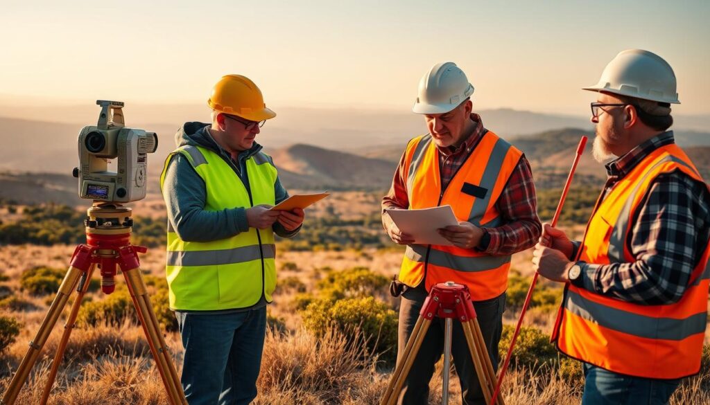
The field of surveying demands a high level of expertise, which is achieved through rigorous educational pathways and professional certifications. Surveyors play a critical role in civil engineering and construction projects, requiring them to be highly skilled and knowledgeable.
Specialized education is fundamental for surveyors, providing them with the theoretical foundations and practical skills necessary for their profession. Educational programs in surveying cover a wide range of topics, including geodetic surveying, land surveying, and geographic information systems (GIS).
Educational Pathways
Aspiring surveyors typically pursue a degree in surveying, civil engineering, or a related field. These programs are offered at various institutions, including universities and technical colleges, and may lead to an associate’s or bachelor’s degree.
Coursework in surveying programs includes subjects such as mathematics, geography, and land surveying principles. Many programs also offer hands-on training through internships or fieldwork, providing students with practical experience.
Professional Certifications
In addition to formal education, professional certifications are essential for surveyors to demonstrate their competence and expertise. In the United States, the primary certification for surveyors is the Professional Land Surveyor (PLS) credential, which is issued by state licensing boards.
To become a PLS, surveyors must meet specific requirements, including passing the Fundamentals of Surveying (FS) exam and the Principles and Practice of Surveying (PS) exam, administered by the National Council of Examiners for Engineering and Surveying (NCEES).
Certification not only validates a surveyor’s knowledge and skills but also enhances their career prospects and professional credibility.
Conclusion: The Future of Surveying in Civil Engineering
The surveying landscape is evolving rapidly, driven by technological advancements and innovative techniques. As construction surveying and topographic surveying continue to play critical roles in civil engineering projects, surveyors must stay abreast of the latest developments to remain effective.
New tools and techniques, such as drones and LiDAR, are making surveying faster, more accurate, and more efficient. These advancements allow surveyors to gather more data and create more detailed representations of the land than ever before. For more information on the role of surveying in engineering, visit McClure Vision.
Staying Current with Industry Developments
To remain relevant, surveyors must commit to continued learning, embracing innovations in surveying techniques and technologies. This commitment will enable them to provide high-quality services, driving success in construction projects and beyond.
Embracing Innovation
The future of surveying in civil engineering depends on the ability to adapt to new technologies and methodologies. By doing so, surveyors can ensure that their work continues to meet the evolving needs of the industry.
