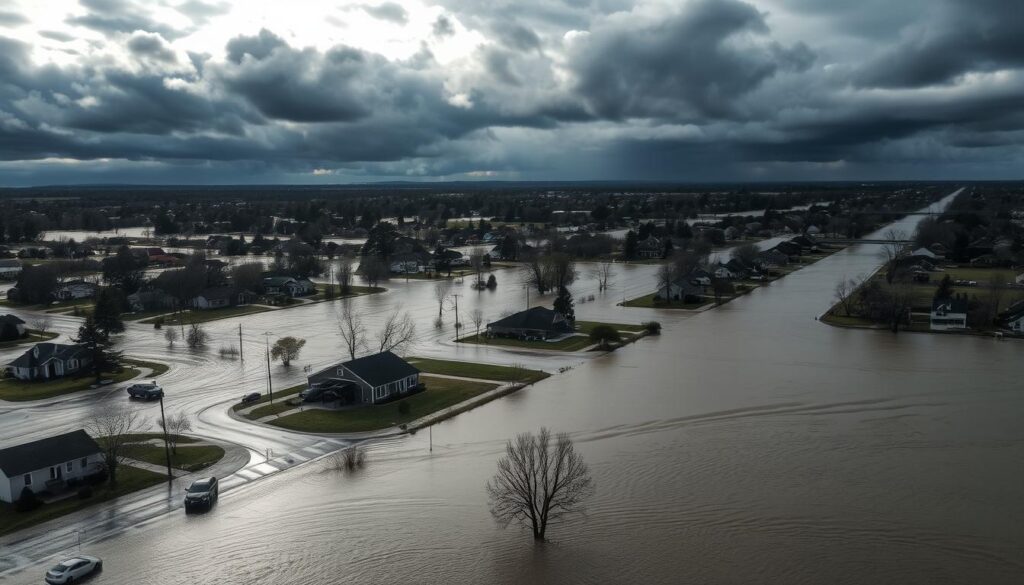
Did you know that since 1980, $281 million of FEMA flood insurance claims have been paid in Indiana alone? This staggering figure highlights the significant financial impact of flooding on properties. Understanding and mitigating flood risks is crucial for homeowners and businesses to protect their assets.
A flood risk analysis can help identify potential vulnerabilities and guide proactive measures to safeguard properties. By taking a proactive approach, individuals can reduce the likelihood of damage and associated costs.
Key Takeaways
- Understanding flood risks is crucial for protecting properties.
- FEMA has paid $281 million in flood insurance claims in Indiana since 1980.
- A flood risk assessment can help identify potential vulnerabilities.
- Proactive measures can reduce the likelihood of damage and associated costs.
- Homeowners and businesses can benefit from flood risk analysis.
Understanding Flood Risk Assessment
As flooding becomes more frequent and severe, assessing flood risk has become a vital step in property management. Flood risk assessment is a comprehensive process that evaluates the potential for flooding and its impact on properties.
What is Flood Risk Assessment?
Flood risk assessment involves analyzing various factors to determine the likelihood and potential consequences of flooding. This process includes examining historical flood data, geographical characteristics, and environmental conditions to predict future flood events. Effective flood risk management relies heavily on accurate assessments to mitigate potential damages.
For instance, properties located in high-risk flood zones are required to have flood insurance if they have mortgages from federally regulated or insured lenders. This underlines the importance of understanding flood risks for both property owners and financial institutions.
Importance of Flood Risk Assessment
The significance of flood hazard assessment cannot be overstated. It not only helps in identifying areas at risk but also aids in implementing measures to reduce or prevent flood damage. By understanding the flood risks, property owners can take proactive steps to protect their investments.
| Benefits of Flood Risk Assessment | Description |
|---|---|
| Informed Decision Making | Helps property owners make informed decisions about their properties. |
| Risk Mitigation | Aids in implementing measures to reduce or prevent flood damage. |
| Financial Protection | Reduces financial losses by identifying potential flood risks early. |
By conducting a thorough flood risk assessment, property owners can enhance their understanding of the risks associated with their properties and take necessary precautions. This proactive approach is crucial in today’s climate, where the frequency and severity of flooding are on the rise.
Types of Flood Risks
Flood risks can be broadly classified into three main categories: coastal, river, and urban flooding. Understanding these different types is essential for effective flood zone mapping and implementing appropriate mitigation measures.
Coastal Flooding
Coastal flooding occurs when seawater inundates coastal areas, often due to storm surges, high tides, or sea-level rise. This type of flooding is particularly concerning for communities near the ocean, where the risk of flooding can be exacerbated by climate change. Advanced hydrological modeling techniques are used to predict and prepare for coastal flood events.

River Flooding
River flooding happens when water levels in rivers or streams overflow, causing water to spill over into surrounding areas. This can be due to heavy rainfall, snowmelt, or dam failures. River flooding can have devastating effects on nearby communities, highlighting the importance of accurate flood zone mapping to identify and mitigate these risks.
Urban Flooding
Urban flooding occurs in urban areas, often as a result of heavy rainfall that overwhelms drainage systems or due to infrastructure failures. This type of flooding can lead to significant disruptions in daily life and economic activities. The use of hydrological modeling helps in understanding and predicting urban flood risks, enabling cities to develop more effective flood management strategies.
The First Street Foundation’s Flood Factor™ score, which ranges from 1 to 10, is a valuable tool for assessing flood risks. It represents both a property’s risk of flooding and the severity of flooding over a 30-year period, providing a comprehensive view of the potential flood risks a property may face.
By understanding the different types of flood risks and utilizing tools like flood zone mapping and hydrological modeling, communities can better prepare for and mitigate the impacts of flooding.
Key Factors Affecting Flood Risk
Several key factors affect flood risk, including geography, climate change, and local infrastructure. Understanding these factors is essential for effective flood risk mitigation strategies.
Geography and Topography
The geography and topography of an area play a significant role in determining its flood risk. Regions with low elevation, near bodies of water, or with certain landforms are more prone to flooding. For instance, coastal areas are susceptible to storm surges, while riverine areas can experience flooding due to heavy rainfall or snowmelt.
Climate Change Impact
Climate change has a profound impact on flood risk. Rising sea levels, increased precipitation, and more frequent extreme weather events contribute to a higher likelihood of flooding. As the planet continues to warm, these trends are expected to intensify, making it crucial to consider climate change in flood risk assessments.
For more information on how climate change affects flood risk, you can explore resources that discuss the latest research and findings on this topic, such as those available at Reduce Flooding.
Local Infrastructure
Local infrastructure, including drainage systems, levees, and floodwalls, significantly influences flood risk. Well-designed and maintained infrastructure can reduce the risk of flooding, while inadequate or failing systems can exacerbate it. FEMA’s flood maps are instrumental in determining insurance and building code requirements, helping communities prepare for and mitigate flood risks.
By understanding and addressing these key factors, communities can develop effective strategies for flood risk mitigation. Utilizing tools like FEMA flood maps and considering the impact of climate change are crucial steps in this process.
Regulatory Framework for Flood Risk
Navigating the regulatory framework for flood risk is essential for property owners, policymakers, and stakeholders to ensure compliance and mitigate flood risks. The National Flood Insurance Program (NFIP) is a federal program designed to reduce the impact of flooding by providing flood insurance policies to property owners, renters, and businesses.
FEMA Guidelines
The Federal Emergency Management Agency (FEMA) plays a crucial role in flood risk management through its guidelines and regulations. FEMA’s flood risk assessment guidelines are pivotal in determining flood risk zones and insurance rates. These guidelines help in identifying areas prone to flooding and implementing measures to mitigate flood risks.
Floodplain mapping is a critical component of FEMA’s guidelines, as it helps in identifying flood-prone areas. Accurate floodplain maps are essential for effective flood risk management and are used to determine flood insurance rates.

Local and State Regulations
In addition to FEMA guidelines, local and state regulations play a significant role in managing flood risks. These regulations can include zoning laws, building codes, and ordinances that are designed to mitigate the impact of flooding. Compliance with these regulations is crucial for property owners to avoid penalties and ensure their properties are protected.
The following table summarizes key aspects of the regulatory framework for flood risk:
| Regulatory Component | Description | Impact on Flood Risk |
|---|---|---|
| FEMA Guidelines | Flood risk assessment and floodplain mapping | Determines flood insurance rates and identifies flood-prone areas |
| Local and State Regulations | Zoning laws, building codes, and ordinances | Mitigates flood impact through compliance and proper planning |
| National Flood Insurance Program (NFIP) | Provides flood insurance policies | Reduces financial impact of flooding on property owners and businesses |
Understanding and complying with the regulatory framework for flood risk is essential for effective flood risk management. By adhering to FEMA guidelines and local and state regulations, stakeholders can mitigate the impacts of flooding and ensure a safer, more resilient community.
The Flood Risk Assessment Process
The flood risk assessment process is a multi-step procedure that helps identify potential flood hazards and evaluate the risk they pose to properties and communities.
To initiate this process, an Initial Site Evaluation is conducted. This involves assessing the site’s geography, including its elevation, proximity to water bodies, and existing flood protection measures. Tools like the Indiana Floodplain Information Portal (INFIP), a mapping application that provides floodplain information for public use, can be invaluable during this phase.
Initial Site Evaluation
During the initial site evaluation, professionals examine historical flood data, local infrastructure, and environmental factors that could influence flood risk. This step is crucial for understanding the site’s vulnerability to flooding.
Data Collection Methods
Effective data collection is critical for a comprehensive flood risk analysis. Various methods are employed, including:
- Hydrological modeling to simulate rainfall-runoff processes and predict flood events.
- Geographic Information Systems (GIS) to analyze spatial data related to floodplains and topography.
- Remote sensing technologies to gather data on land use, vegetation, and other environmental factors.
These data collection methods help in creating detailed models that can predict flood risks under different scenarios.
Analyzing Flood Risks
Once the data is collected, it is analyzed to determine the likelihood and potential impact of flooding. This involves using hydrological modeling to simulate different flood scenarios and assess the vulnerability of the area. The analysis helps in identifying areas at high risk and informs the development of strategies to mitigate these risks.
By understanding the flood risk assessment process, communities and property owners can take proactive steps to reduce their vulnerability to floods. This not only enhances safety but also contributes to more resilient and sustainable development.
Tools and Technologies Used
Advanced technologies play a crucial role in assessing flood risks today. The integration of sophisticated tools and methodologies has significantly enhanced the accuracy and effectiveness of flood risk assessments.
Geographic Information Systems (GIS)
GIS technology is pivotal in flood zone mapping, allowing for the precise identification of areas at risk. By analyzing spatial data, GIS helps in understanding the topography and geography of a region, which is crucial for assessing flood risks.

Flood Modeling Software
Flood modeling software utilizes complex algorithms to predict flood behaviors and potential impacts. The First Street Foundation’s Flood Model, for instance, integrates all major flood types and uses historical flooding events to calculate risk, providing valuable insights for stakeholders.
For more information on how technologies like AI are transforming civil engineering, visit this resource.
Remote Sensing
Remote sensing technology, including satellite imagery, plays a vital role in monitoring and assessing flood risks. It enables the collection of data over large areas, helping in the identification of flood-prone zones and the impact of climate change on flood patterns.
Assessing Vulnerabilities
Understanding the vulnerabilities of a property or community is essential in mitigating flood risks. Assessing vulnerabilities involves evaluating various factors that could impact the severity of flood damage.
Property Characteristics
Property characteristics play a significant role in determining flood risk. Factors such as elevation, proximity to water bodies, and construction materials can affect a property’s vulnerability to flooding. For instance, properties with elevated foundations and flood-resistant materials are less likely to suffer damage. According to the National Academies, understanding these characteristics is crucial for effective flood risk management.
Community Impact
The impact of flooding on a community can be significant, affecting not only individual properties but also infrastructure, businesses, and the overall economy. Assessing community impact involves evaluating the potential consequences of flooding on a larger scale. For example, flooding can disrupt critical infrastructure, such as hospitals and emergency services, and can also affect local businesses, leading to economic losses. Effective flood risk management strategies can help mitigate these impacts.
Emergency Response Plans
Having emergency response plans in place is critical for minimizing the impact of flooding. These plans should include evacuation routes, emergency shelters, and communication strategies. Communities can benefit from having well-coordinated emergency response plans that involve local authorities, emergency services, and the public. According to experts, such plans can significantly reduce the risk of injury or loss of life during flood events.
| Vulnerability Factor | Description | Impact on Flood Risk |
|---|---|---|
| Property Elevation | Properties at lower elevations are more susceptible to flooding. | High |
| Proximity to Water Bodies | Properties near rivers, coastlines, or other water bodies are at higher risk. | High |
| Construction Materials | Properties built with flood-resistant materials are less vulnerable. | Low |
Benefits of Flood Risk Assessment
Flood risk assessments offer numerous benefits, including enhanced property value and reduced insurance premiums. By understanding the flood risks associated with a property, owners can take proactive measures to mitigate potential damages, thereby increasing the property’s resilience and value.

Enhancing Property Value
A flood risk assessment can significantly enhance property value by identifying potential flood risks and recommending mitigation strategies. This not only protects the property from flood damage but also makes it more attractive to potential buyers, thereby increasing its market value.
Key benefits include:
- Increased property resilience to flooding
- Improved marketability
- Enhanced buyer confidence
Insurance Premium Reduction
One of the significant advantages of conducting a flood risk assessment is the potential reduction in insurance premiums. By mitigating flood risks, property owners can demonstrate to insurance providers that their property is less susceptible to flood damage, leading to lower premiums.
FEMA flood maps play a crucial role in this process, as they provide detailed information on flood risk zones. Properties located in lower-risk areas, as identified by these maps, can benefit from reduced insurance costs.
Improved Safety Measures
Flood risk assessments also lead to improved safety measures for properties. By identifying potential flood risks, property owners can implement measures to protect their properties, such as installing flood barriers or improving drainage systems.
Having flood insurance is also highly recommended, as it provides financial protection in the event of a flood. As the data suggests, “Having flood insurance is the best solution to a faster and more whole recovery after a flood event.”
Some of the improved safety measures include:
- Installation of flood protection systems
- Regular maintenance of drainage infrastructure
- Development of emergency response plans
How to Prepare for a Flood Risk Assessment
Before conducting a flood risk assessment, it’s essential to take several preparatory steps to ensure a smooth and effective process. Understanding the requirements and gathering necessary information can significantly enhance the outcome of the assessment.
Gather Essential Documents
Gathering essential documents is a critical step in preparing for a flood risk assessment. Property owners should start by collecting all relevant property documents, including deeds, titles, and any existing flood risk assessments or insurance policies. Additionally, having detailed information about the property’s elevation, topography, and any flood mitigation measures in place can be invaluable. The Indiana Department of Homeland Security encourages all Hoosier homeowners and renters to purchase flood insurance protection, which can also be a crucial document to have during the assessment.
For a comprehensive assessment, it’s also beneficial to have records of any past flooding incidents, including photographs and descriptions of the damage. This information can help assessors understand the property’s flood risk history and identify potential vulnerabilities.
Understand Your Property’s History
Understanding your property’s history is vital in assessing its flood risk. This includes knowing the property’s past flood events, its location within a floodplain mapping zone, and any historical data on flood risks in the area. Property owners can research local records or consult with local authorities to gather this information.
Moreover, understanding the property’s topography and how it might be affected by climate change is crucial. For instance, properties located near rivers or coastal areas may have different flood risk factors compared to those inland. Engaging with local flood risk management resources can provide valuable insights into these factors.
Engage with Local Authorities
Engaging with local authorities is another important step in preparing for a flood risk assessment. Local government offices, such as planning or emergency management departments, can provide critical information on flood risk zones, local regulations, and recommended flood mitigation strategies. They can also offer guidance on how to interpret floodplain mapping data and how it applies to your property.
Furthermore, local authorities can inform property owners about any upcoming flood risk management initiatives or community programs aimed at reducing flood risks. Participating in these programs or staying informed about local flood risk management efforts can significantly benefit property owners in the long run.
Common Misconceptions about Flood Risk
The notion that floods only occur in certain areas is a dangerous misconception that needs to be addressed. Many believe that floods are limited to high-risk zones, but the reality is that flooding can happen anywhere, and it’s crucial to understand the true nature of flood risk.

Floods are not just limited to coastal or riverine areas; they can occur due to various factors, including heavy rainfall, storm surges, and infrastructure failures. For instance, flood zone myths vs. facts reveal that a significant number of flood claims come from areas considered to be at low to moderate risk.
Floods Only Happen in Certain Areas
It’s a common myth that floods only happen in designated flood zones. However, data shows that 40% of all flood claims occur in low- to moderate-risk areas, highlighting the importance of flood insurance beyond high-risk zones. This statistic underscores the need for awareness and preparedness across a broader geographic area.
- Floods can be caused by a variety of factors, not just proximity to water bodies.
- Urban flooding, for example, is a growing concern due to increased urbanization and climate change.
- Flood risk assessment is crucial for all properties, regardless of their perceived risk level.
Insurance Covers All Flood Damage
Another misconception is that insurance covers all types of flood damage. While flood insurance is essential, the extent of coverage can vary significantly depending on the policy. It’s essential to understand what is covered and what is not to avoid surprises during a flood event.
- Review your insurance policy to understand the coverage limits and exclusions.
- Consider additional coverage options if necessary, such as coverage for contents or additional living expenses.
- Flood risk assessment can help identify potential vulnerabilities and guide insurance decisions.
In conclusion, understanding the true nature of flood risk and dispelling common misconceptions is crucial for effective flood risk management. By being informed and prepared, property owners can better protect themselves against the financial and emotional impacts of flooding.
Case Studies of Flood Risk Assessments
According to recent data, approximately 14.6 million properties are at substantial risk of flooding, highlighting the need for comprehensive flood risk assessments. This staggering figure is about 70% more than the number identified by FEMA, underscoring the importance of advanced flood modeling and risk assessment techniques.
Successful Mitigation Strategies
Several case studies have demonstrated the effectiveness of flood risk mitigation strategies. For instance, communities that have implemented floodplain management practices and upgraded their infrastructure have seen a significant reduction in flood damage.
Flood risk mitigation efforts, such as the restoration of wetlands and the creation of flood buffers, have not only reduced the risk of flooding but also enhanced biodiversity and ecosystem services.
- Implementing flood-control measures like levees and floodwalls
- Enhancing stormwater management systems
- Restoring natural habitats that mitigate flood risk
Lessons Learned from Past Disasters
Past flood disasters have provided valuable lessons on the importance of preparedness and effective flood risk management. For example, the aftermath of Hurricane Katrina highlighted the need for robust levee systems and comprehensive emergency response plans.
“The devastation caused by flooding is not just a result of the flood itself, but also of the lack of preparedness and inadequate risk assessment,” said a flood risk expert.
These lessons have been instrumental in shaping current flood risk assessment practices, emphasizing the need for proactive measures and community engagement.
By studying past disasters and applying the lessons learned, communities can develop more effective strategies for managing flood risk, ultimately reducing the impact of floods on properties and lives.
How to Choose a Flood Risk Assessment Company
With numerous flood risk assessment companies available, it’s essential to know what to look for to make an informed decision. Choosing the right company can significantly impact the accuracy of the flood risk analysis and the effectiveness of the subsequent mitigation strategies.
Credentials and Experience
The first step in selecting a flood risk assessment company is to evaluate their credentials and experience. Look for companies that have certified professionals on their team, such as Certified Floodplain Managers (CFMs) or Professional Hydrologists. Experience in conducting flood risk assessments is also crucial, as it indicates the company’s ability to handle complex projects.

Service Offerings
A comprehensive flood risk assessment company should offer a wide range of services, including flood zone mapping, flood risk analysis, and mitigation planning. Ensure that the company you choose can provide all the services you need to protect your property effectively.
Client Testimonials
Client testimonials and case studies can provide valuable insights into a company’s performance and reliability. Look for reviews and testimonials from previous clients to gauge the company’s reputation and the quality of their work. This can help you make a more informed decision when selecting a flood risk assessment company.
By carefully evaluating a company’s credentials, experience, service offerings, and client testimonials, you can choose a reliable flood risk assessment company that meets your needs and helps protect your property from flood risks.
Next Steps After an Assessment
After completing a flood risk assessment, the next crucial steps involve implementing the recommendations provided and creating a comprehensive flood preparedness plan. This proactive approach is essential for effective flood risk mitigation and reducing potential damages.
Putting Recommendations into Action
Implementing the recommendations from a flood hazard assessment can significantly reduce the risk of flooding. This may include installing flood protection measures, elevating critical infrastructure, or adopting flood-resilient construction practices. By taking these steps, property owners can enhance their property’s resilience to flooding.
Developing a Flood Preparedness Plan
A well-structured flood preparedness plan is vital for ensuring a swift response to flood events. This plan should outline emergency procedures, evacuation routes, and communication strategies. Regular updates and drills will help ensure that all stakeholders are prepared to respond effectively in the event of a flood.